In the Metropolitan Commons (Mitcham Supplemental) Act of 1891, Mitcham Common, Upper Green, Lower Green, Figges Marsh and Beddington Corner came under the ownership and control of the Board of Conservators.
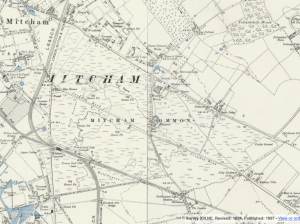
1894 OS map Mitcham Common
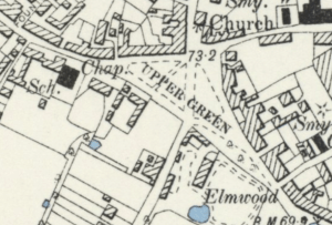
1894 OS map Upper Green
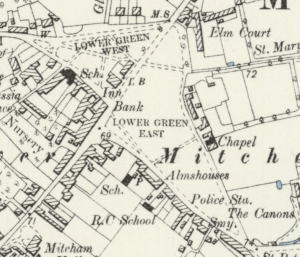
1894 OS map Lower Green
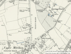
1894 OS map
The Mitcham Urban District Council Act 1923 allowed the Mitcham Urban District Council (UDC) to buy from the Conservators the open spaces of Upper (or Fair) Green, Lower (or Cricket) Green, Figges Marsh , Three Kings Piece and Canons Piece. These open spaces were then referred to in this Act as the “Mitcham Greens”.
In 1934, the Mitcham Urban District Council was changed to the Mitcham Borough Council. A notice by the Privy Council Office, published in The Advertiser on 17th May 1934, included the ‘Property and Liabilities’ of the District Council.
In 1964 Mitcham Borough Council became part of the London Borough of Merton.
The Greater London Council Commons Registration Act 1965 refers to Mitcham Common as exempt from registration, but does add the “Town Greens” of Figges Marsh, Upper Green, Lower and Cricket Green.
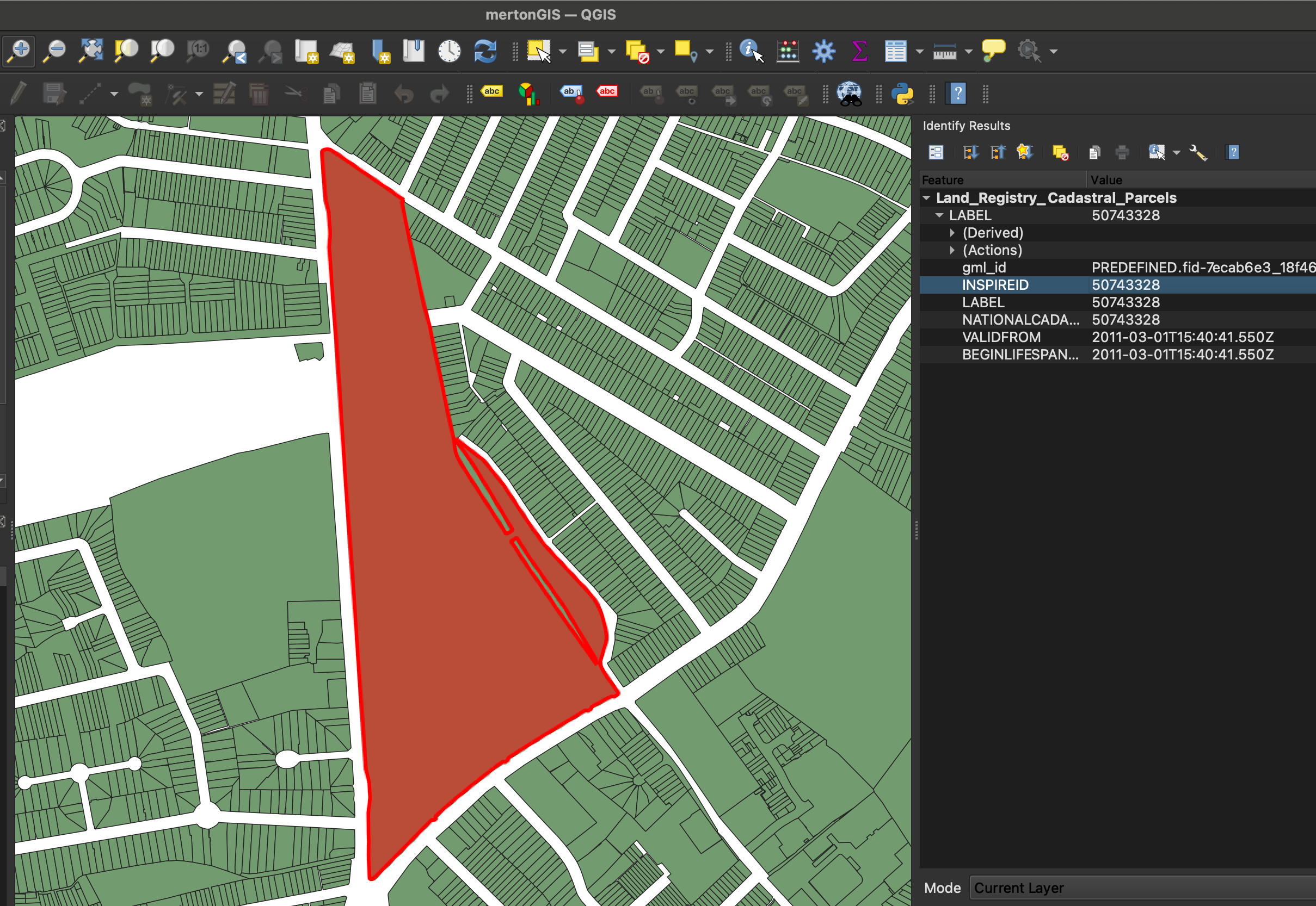
The current GIS map of freehold properties in Merton shows that the Lower Green hasn’t been registered.
This uses data from the Land Registry, under Open Government Licence: “This information is subject to Crown copyright and database rights 2024 and is reproduced with the permission of HM Land Registry.”
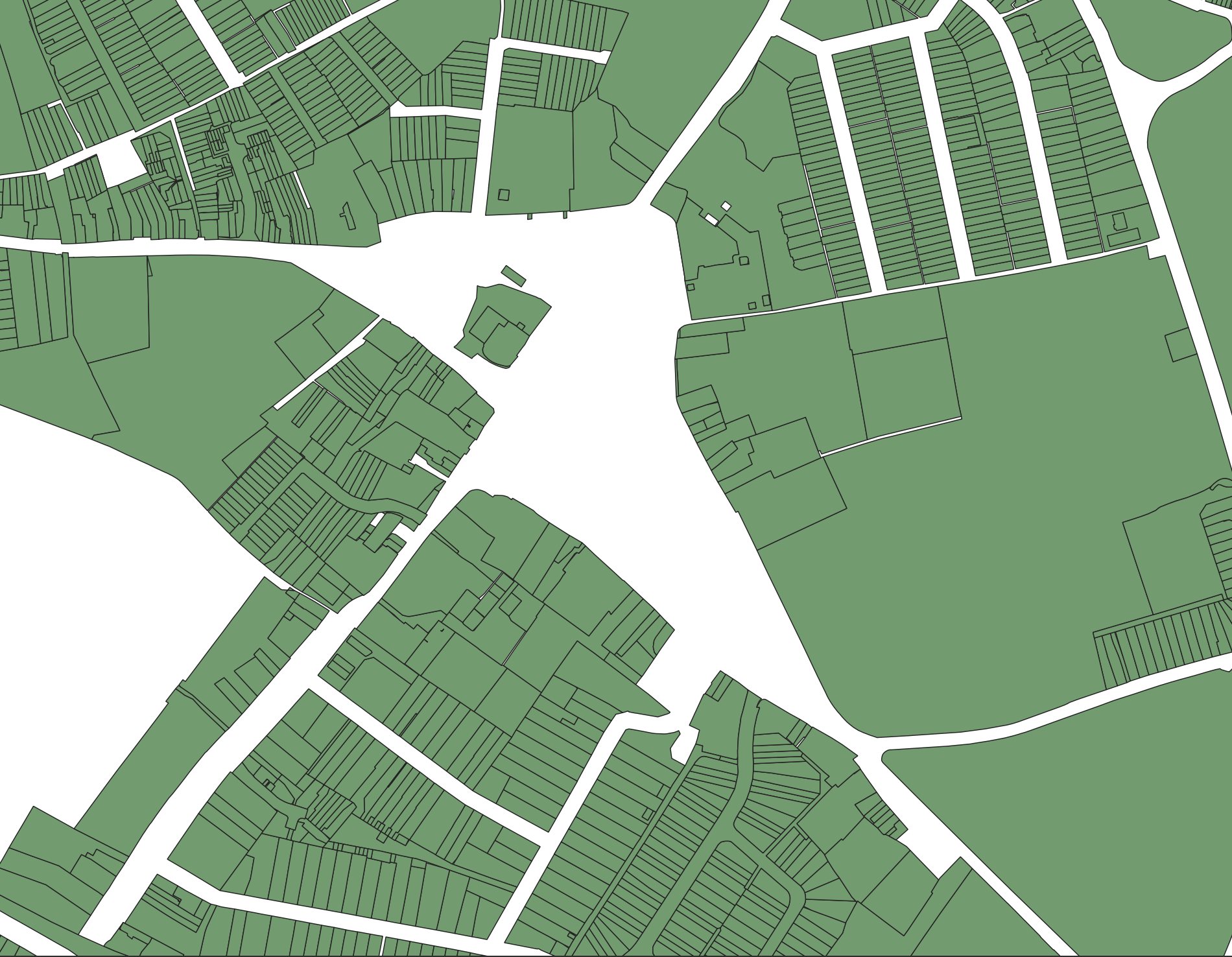
Map produced with QGIS
But Figges Marsh is registered. In this QGIS screenshot, its INSPIRE-ID is 50743328, which can be used with the Land Registry property search.
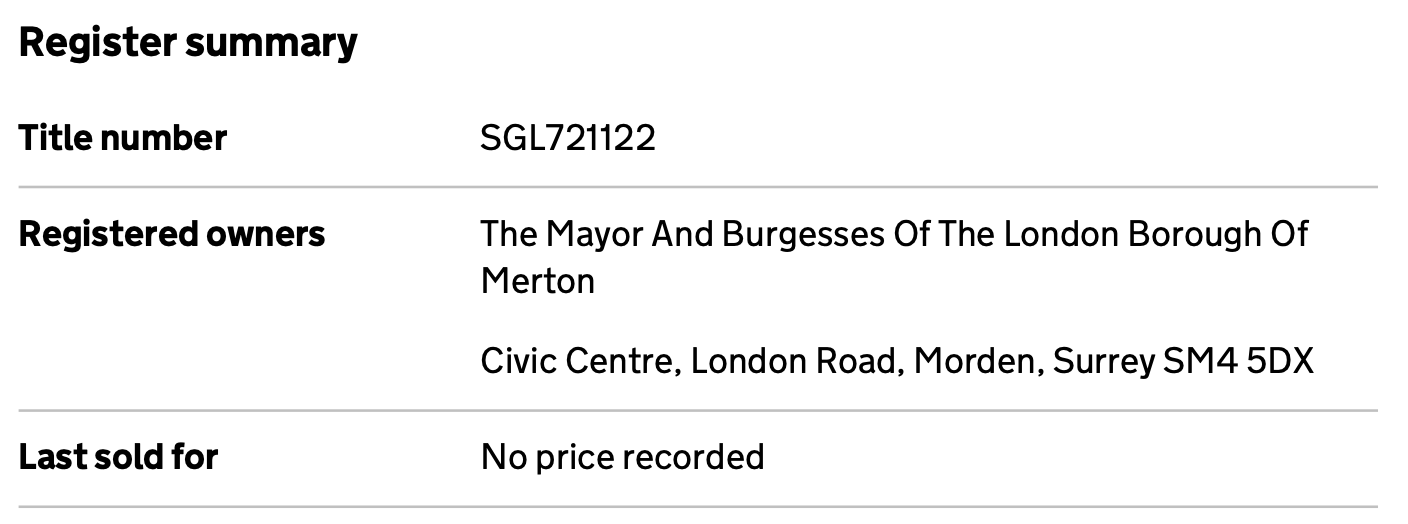
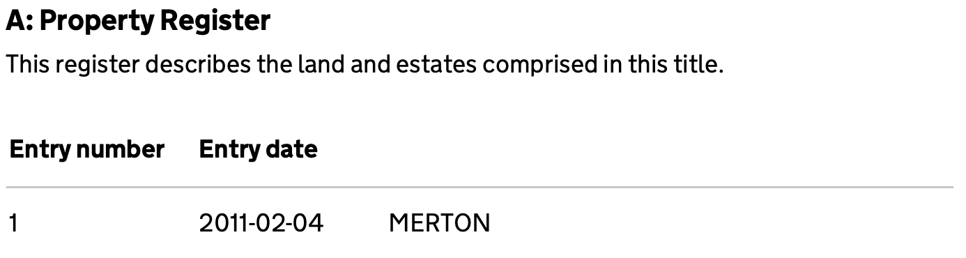
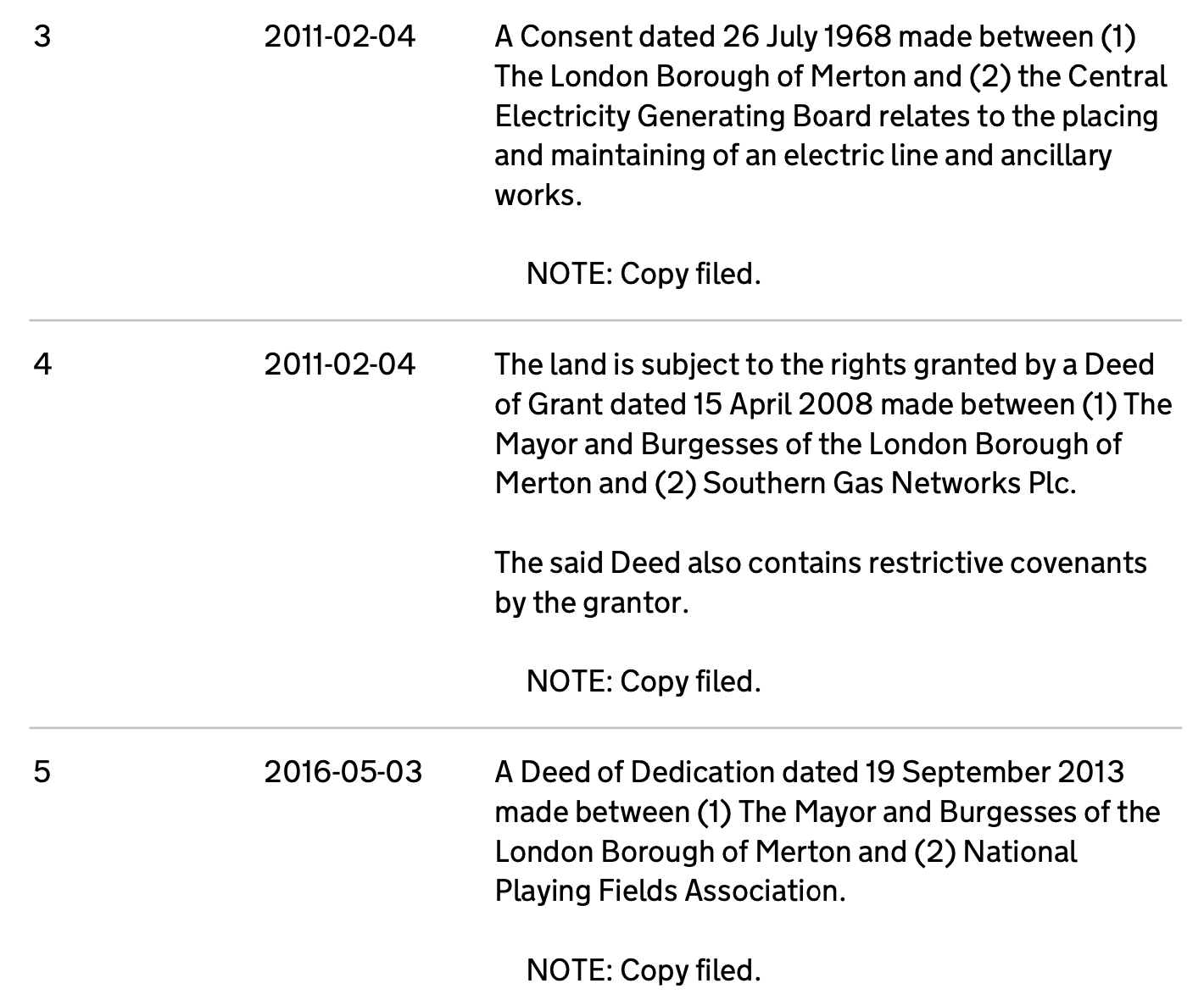
Title SGL721122 was obtained, which shows that Figges Marsh was registered in 2011:
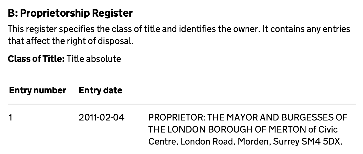
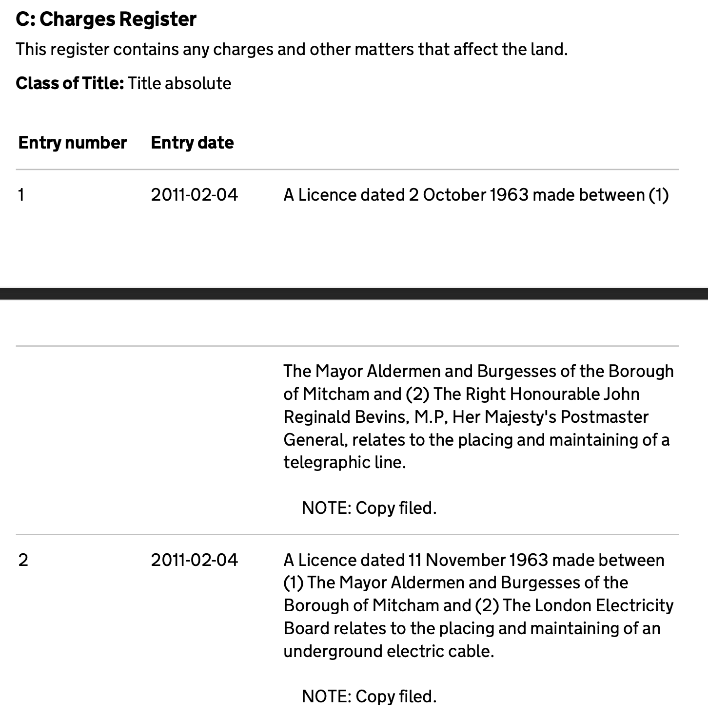
Figges Marsh, one of the Town Greens, was owned by Merton Council while it was unregistered.
In 2011 the Council registered the land.
The C register has references to utility companies.
It is possible then that this Town Green was only registered with the Land Registry because of access needed by utility companies.
Lower Green West and Cricket Green remain unregistered as there may have been no access required by such companies.
Ordnance Survey Maps are reproduced by permission of the National Library of Scotland, reuse CC-BY.
