Railway station off Carshalton Road next to the Golf Course and Mitcham Common. It is currently served by Thameslink and Southern trains, see the National Rail website.
Contents
Maps
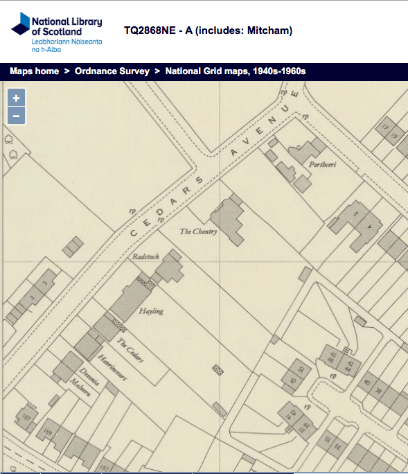
Before the Croydon Tramlink replaced the Wimbledon to Croydon railway line in 2000, Mitcham Junction railway station was a junction, as can be seen in this 1953 OS map:

1953 OS map reproduced by permission of the National Library of Scotland, reuse CC-BY (NLS).
The signal box is shown on this map as ‘SB’, to the east of the platforms. For photos and more information see the Signal Box website.
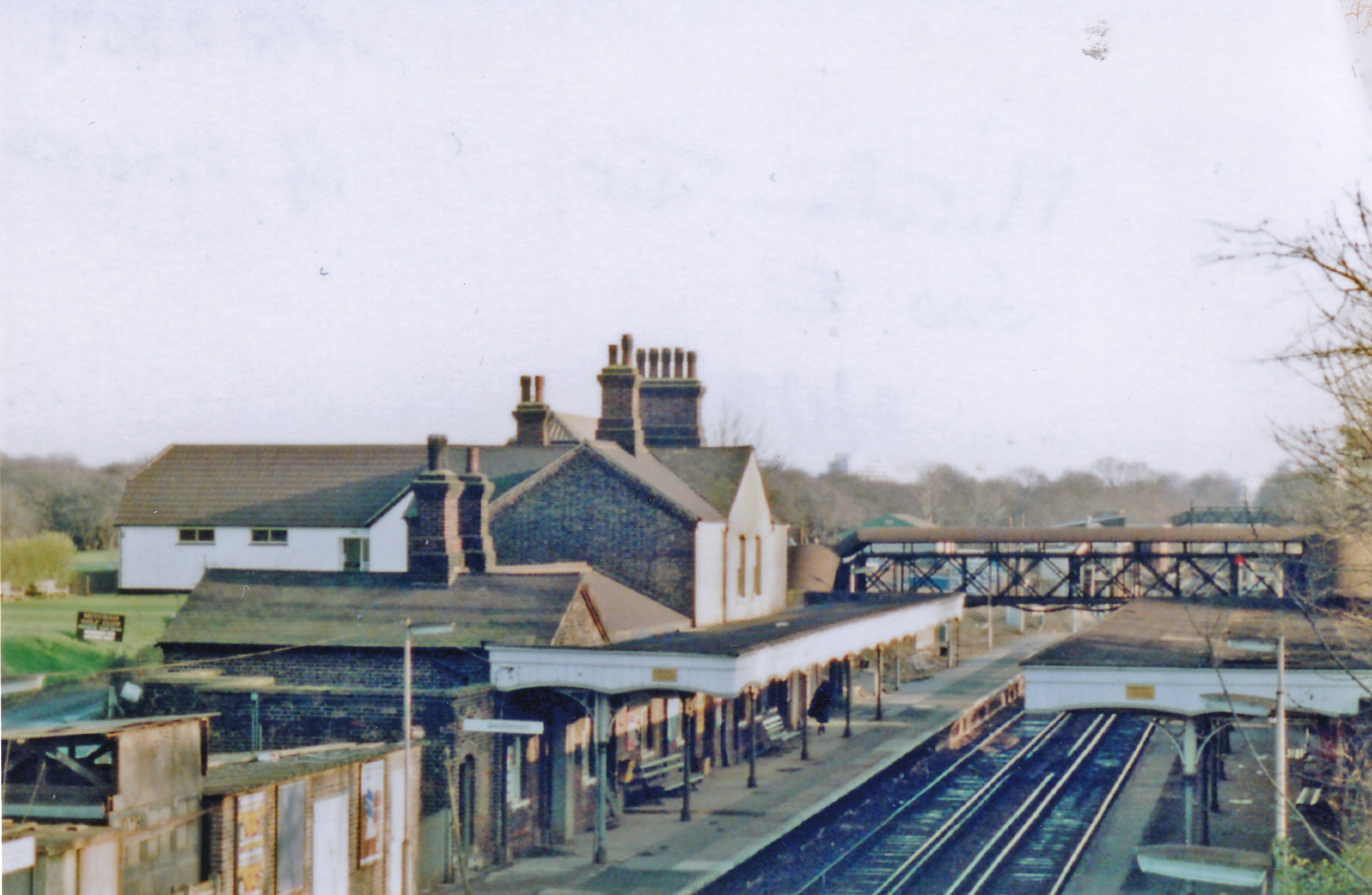
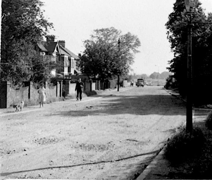
Undated photo by B. Brooksbank and licensed for reuse under the Creative Commons Licence.
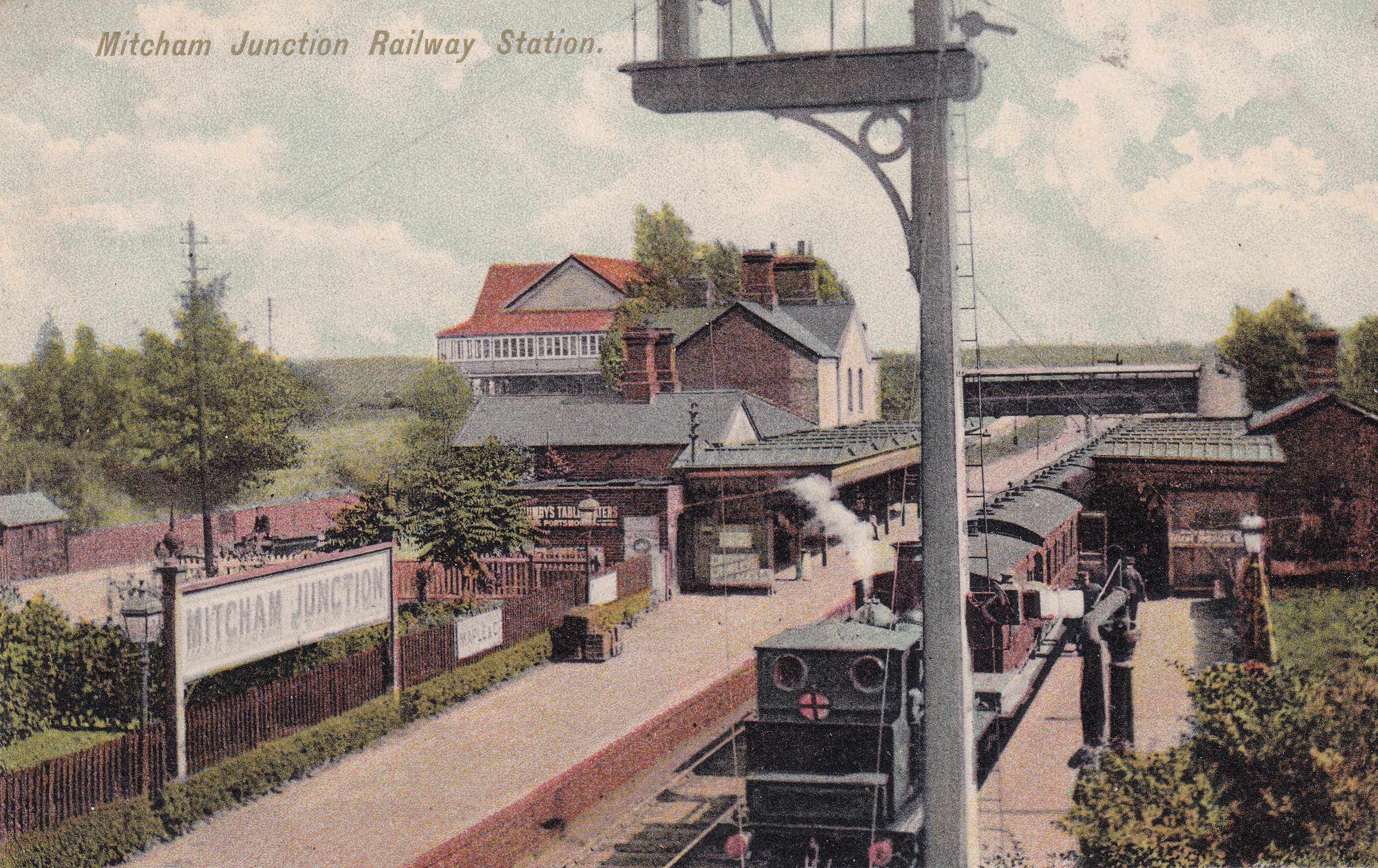
Undated postcard. Reverse of postcard:- “Canon” Series. B. 64. Printed in Saxony.
Older maps

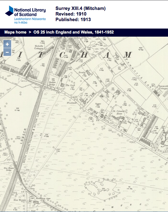
1894 OS map reproduced by permission of the National Library of Scotland, reuse CC-BY

1866 OS map reproduced by permission of the National Library of Scotland, reuse CC-BY
Reconstruction of Mitcham Junction Bridge
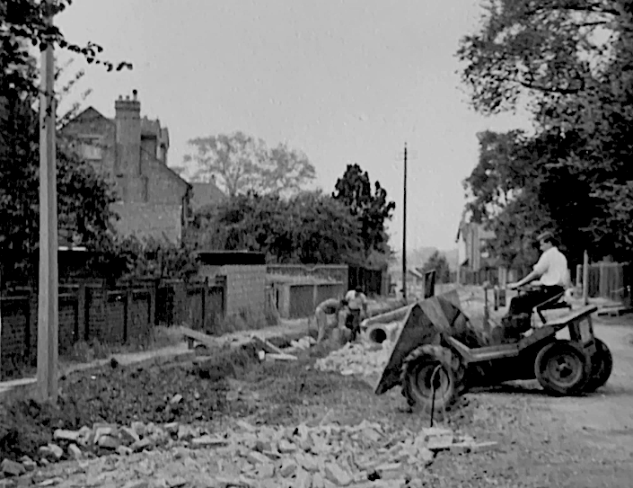
The bridge in Carshalton Road over the lines was widened in 1955, but according to these extracts from Mitcham Borough Council minutes, the work started in 1939 (but was halted due to the war).
10th February 1938
Read letter from Surrey County Council stating that at a meeting held on January 25, 1938, the County Council had sanctioned a contribution of £2,306 or one half of the net cost of the scheme towards the reconstruction of the Mitcham Junction Railway Bridge. Resolved, That the Surrey County Council be informed that as the Carshalton Road is a main county road the Town Council are of opinion that the total net cost be borne by county funds.
10th March 1938
Read letter from Surrey County Council stating that the County Council were not prepared to increase the agreed contribution towards the cost of reconstructing Mitcham Junction Bridge. The Town Clerk reported that he understood that, as a matter of policy, the County Council had decided that in all cases of bridge reconstruction the County Council expect some portion of the cost to be borne by the local authority. Resolved, that the Council accept the contribution offered on January 25, 1938.
16th May 1939
Read letter from the Ministry of Health enclosing the formal consent of the Minister to the borrowing of the following sums in connection with the widening of the bridge over the Southern Railway at Mitcham Junction:-
Acquisition of land £150
Bridge works £1,875
Road works £56623rd May 1939
Read letter from the Demolition and Construction Co. Ltd., enclosing draft of a clause to cover the contract against increase of wages and costs in the event of war, and asking that this clause should be included in the contract for the reconstruction of Mitcham Junction Bridge. Resolved, That the Council agree to the inclusion of this clause in the contract.
From the Norwood News – Friday 22nd July 1955
Bridge widening soon.
Workmen may soon begin widening the bridge over the railway at Mitcham Junction. The Ministry of Transport have promised a grant of £30,825 towards the estimated cost of £41,000 so the work can be completed. It was began before the last war.
Newspaper Articles
Evening News (London) – Monday 30 October 1933
HE FAMILY OF STATION-MASTERS FATHER AND FOUR SONS
When Mr. Ernest Holden retires from the post of stationmaster at Mitcham and Mitcham Junction stations, Southern Railway, to-morrow, a family service with the railway totalling 275 years will come to an end. Mr. Holden has been station-master on the Southern at Mitcham for 10 years, and has had 44 years’ service with the railway. His father was station-master at Drayton and his three brothers (two of whom are still living) were all stationmasters — at Bexhill-on-Sea, Hove and Forest Hill.
Memories of 40 years in signal boxes at Mitcham Junction, an article from the Mitcham Advertiser of 11th October, 1945.
Wavy Canopy Edge of Mitcham Junction
(The following story refers to Mitcham Junction but the rest of the article implies that the body was found near the Eastfields level crossing.)
From the Norwood News – Friday 18 October 1929
CUT TO PIECES.
Depressed man on line at Mitcham.
TRAGEDY OF ILLNESS.
“So as not to alarm my passengers, I ran my train about 100 yards before pulling up,” said the driver of a Southern Railway electric train, at the inquest, on Monday, on Jesse Vince (63), outdoor labourer, of Greyhound-terrace, Lonesome, Mitcham, whose decapitated body was found on the line at Eastfields, Mitcham, the previous Thursday night.
The inquest was held at Mitcham mortuary chapel by the deputy-coroner for Surrey, who sat with a jury, of which Mr. Champion was foreman.
Mrs. Elisabeth Vince, the widow, who was greatly distressed, said her husband had been ill about 13 weeks, suffering from sun-stroke. He had seen a doctor. He was always complaining of his head aching.
The coroner: What was he depressed about?
– Because be felt ill and could not get work. That is the truth, sir.REPORTED MISSING.
Witness added that her husband had never threatened to take his life. He left home about half past three on Thursday afternoon, the 10th inst. He did say where he was going. As he had not returned at 9.30 — his usual time being about 5 o’clock—witness informed the police that he was missing.
Frederick Parker, of New Cross, an engine driver on the Southern Railway, said he was driving the 6.30 train from Victoria to Epsom Town and when approaching the footbridge at Mitcham Junction signal box, his train struck something on the line. It was dark and he had seen nothing.
“So as not to alarm my passengers.” added witness, “I ran my train about 100 yards before pulling up, I then informed the man in the signal box, and asked him to have the line searched before another train passed over it.”
Witness further stated that he could find no marks on the train. The level-crossing gates were closed when he passed.
LINE SEARCHED
John Wyatt, of Eastfields, Mitcham, the signalman, said when the last witness informed him of his suspicions he arranged for the line to be searched. Witness had seen no one loitering on the line. He could not have missed seeing a man if he had got on the line at the level crossing. There was no right-of-way, or footpath, apart from this crossing.
James Percy Douglas Edwards, of Gipsy-hill, Upper Norwood, a shunter, spoke to searching the line and finding the decapitated body of deceased. It was terribly mutilated. Witness picked up a watch and chain. He informed the police.
“I have been given to understand,” added witness, “that deceased worked for Messrs. Mizen Bros., the market gardeners, and, knowing the spot, it would be possible for him to get on to the line from their greenhouses, which back on to the railway.”
FINGER PRINTS.
John William Coleman, a railway detective, said he had examined the scene, and discovered several finger prints which indicated that the man got on to the line by climbing a small tree and mounting a wall.
P.-c. William Kemp, attached to the Mitcham Police Station, spoke to recovering the remains and helping to remove them to the mortuary. The property on the body included a razor. Witness did not think it possible for the man to have got on to the line from Messrs. Mizen’s greenhouses. He thought the only way of access was from the public level crossing.
STRUCK BY TRAIN.
Dr. Bentley said the body was terribly cut up, and he came to the conclusion that the man must have been lying down when the train struck him.
Summing up, the deputy-coroner said the evidence all pointed to deceased being a trespasser on the railway. He had no ticket, and there was no suggestion that he was a passenger and fell out of the train. The witnesses all said it was difficult for a man to get on to the line, but possibly it was not so hard after all to a man who knew the place, as deceased did.
The jury returned a verdict of ” Suicide whilst of unsound mind. “
Anecdotes
From a train driver via Twitter:
Brick thrown at windscreen of train
I have one memory of an incident there circa 2003. I was watching what I thought was plastic bag blowing about in the wind. I watched it as it ‘blew’ towards my train. It occurred to me it wasn’t just a plastic bag. Someone had put a brick in it & it shattered my windscreen.
I was shocked & a little shaken up, the windscreen bore the damage it was safety glass. The train had to come out of service & that service was cancelled.
People have done all sorts to damage trains, molotov cocktails, trolleys thrown off bridges, items on the line to de-rail trains.
My experience in buying tickets in around 2015:
I’d used the online journey planner for a trip to Collington, near Bexhill-on-sea, for visiting relatives there. I had the notes and coins to make the exact cost of the ticket, and I set off by tram to Mitcham Junction. The chap at the ticket office at the station seemed surprised by the destination. He remarked that he had never sold a ticket for that station before. He told me the fare, I don’t recall how much it was, and I then counted out the exact fare. He seemed to freeze, in fact he was almost shocked, and said that being given the exact fare was most unusual. “This is such a small station,” he said. “People often present a £20 note for a fare that’s less than £10, sometimes less than £5.” He grinned. He was grateful of getting the exact money.