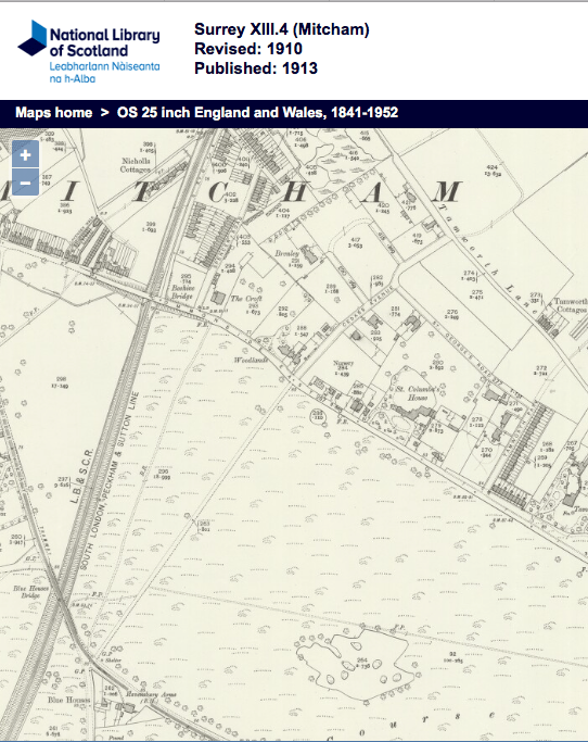
Road that runs south westerly from Tamworth Lane to Commonside East where it crosses Mitcham Common to Croydon Road near the junction with Carshalton Road. The part of the road across the Common was a footpath until it was widened in 1930/31.
From the minutes of the Mitcham Urban District council
Volume XVI May 1930 to April 1931
Highways Committee
4th June 1930
Page 115
IMPROVEMENTS.
I lay before you plans for the construction of a new road from Watneys Road to Galpins Road at an estimated cost of £3,880.
I also lay before you plans for the widening and reconstruction of New Road from the common from Blue House Bridge to Cedars Road, at an intimated cost of £5,391.
In both cases it is proposed to maintain a footway on one side only, and in the case of the first mentioned road the width of the carriageway is 18 ft., and in the latter instance 24 ft. with 5 ft. footpath.
Yours obediently,
Riley Schofield, Assoc.M.Inst.C.E.,
Engineer and Surveyor.Resolved –
(f) Improvements, Mitcham Common – That the Committee defer consideration of the plans for construction of a new road from Watneys Road to Galpins Road and for the widening and reconstruction of New Road across the Common from Blue Houses Bridge to Cedars Road, pending the decision of the Conservators with regard to the promotion of a Bill in Parliament.
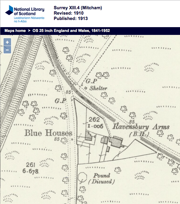
This OS map from 1910 shows the route of road and footpath to the Blue House pub:
1910 OS map
It also shows two large houses off the east side of the road, and opposite the drive that led to Brenley. The names of these can be seen on this 1953 OS map, as The Chantry and Radstock.
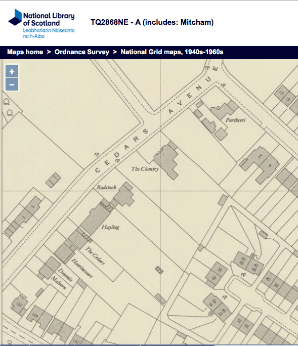
1953 OS map
In the 1964 electoral register, the houses in Cedars Avenue were listed as:
No. 1,3 and 5
Brenley
Newholme
Orchard Cottage
Malvern
Devonia
Havrincourt
The Cedars
Radstock
The Chantry
The Orchard
Malgarry
Clonmel
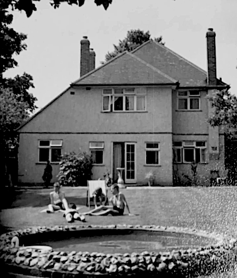
Rear garden of The Orchard. Photo kindly supplied by a former resident.
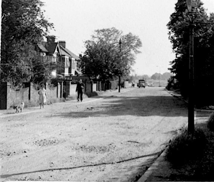
Cedars Avenue looking towards Commonside East. Havrincourt is on the left. Photo kindly supplied by a former resident of The Orchard.
The houses on the east side of the road were renumbered even, starting from the Commonside East end, possibly in the 1930s. The 1939 for sale ad below for Devonia was the same as an ad listed for no. 2.
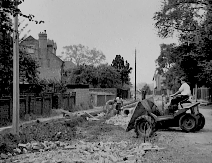
Road being surfaced in the 1960s. See comment below by Alan Hutchings.
News articles and adverts
Norwood News – Friday 14 April 1939
MITCHAM COMMON (partially overlooking).
Bright semi-detached freehold; vacant possession; 2 receptions, 3 bedrooms, kitchen, separate w.c., nice garden; £745. – Apply on premises, “Devonia”, Cedars-avenue, Mitcham; Mitcham 4130.
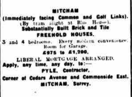
Norwood News – Saturday 13 November 1926
Image © Reach PLC. Image created courtesy of THE BRITISH LIBRARY BOARD.
Text of ad:
MITCHAM
(Immediately facing Common and Golf Links).
(By tram alight at Blue House).
Substantially Built Brick and Tile
FREEHOLD HOUSES.
3 and 4 bedrooms. Every modern convenience.
Room for Garage.
£975 to £1,200.
LIBERAL MORTGAGE ARRANGED.
Apply, any time, any day, to:-
PYLE, Contractor,
Corner of Cedars Avenue and Commonside East,
MITCHAM, Surrey.
Minutes of meetings held by the Mitcham Urban District Council are available on request from the Merton Heritage and Local Studies Centre at Morden Library.
Maps are reproduced with the permission of the National Library of Scotland.