From the Mitcham Advertiser – Thursday 07 July 1927
![]()
MITCHAM NOTES.
Why are all the public houses in High-street, Colliers Wood, on one side—the west side of the road? I asked the Chairman of the Council and he said he must have notice of the question. I asked Mr. Groom-bridge and he thanked heaven he lived in the wilderness on the other side. I asked Coun. Cusden and he said “What does it matter? The beer is just as good at Cusden’s Stores.” I asked Jack Fitch and he said it was a shame. I asked George Bennett and he said that was one of the inequalities the Labour Party was out to remove. I asked Thirsty Bill, who has often been fined 10s. and costs for being all on one side himself, and he said, “Hie-wash-wash I get for tellin’ ya!”
So I led the way to the Blue Nose and Slop Basin and called for two acid drops. Thirsty Bill’s eyesight is getting bad and in mistake he drank both. “Shay, guv’nor,” he hiccoughed, “don’t-tcha berlieve it.” “Believe what?” I asked. “Thash all pubs in thish—thish street—hic—thash all pubs in any streetsh on one sidesh. Nope. Sh’all wrong. Man who shesh pubs in thish tsreetsh all on one shide—sidesh ish—hic—ish drunk.”
In desperation I asked Mr. R. M. Chart. Mr. Chart knows more about the pubs of Mitcham than any man. This statement, I hope, will be taken in the right spirit. With his usual courtesy he let me waste his time while I propounded the more or less important question then said “It’s an interesting point certainly, and, I think, easily explained.”
Mr. Chart reminded me that unknown to many of the residents of Colliers Wood a brook flows down the east side of High-street into the Wandle at Merton. It is under the roadway and was covered in within living memory. It is the same stream that protects Mitcham from Tooting. “It is reasonable to suppose,” he added, “that when High-street was a rural way with an open brook along the whole of its east side the roadside inns were built on the west side to avoid that brook.”
A simple solution, you must agree, of a great mystery to you and me. Evidently mine host of the days of yore took more pains than does Boniface of to-day to pre-vent his customers from mixing their drinks—involuntarily.
It would have been utterly foolish to let Mr. Chart go without asking him for facts about the King’s Head and the grand old elm slain last week to make a motorist’s holiday.
“Time hollowed in its trunk a tomb for centuries,
And buried there the epochs of the rise and fall of states,
The fading generations of the world,
The memory of men.”Mr. Chart not only enlightened me about the King’s Head and the elm, but gave me historical notes of a dozen other Mitcham hostelries. The earliest mention of the King’s Head in the Parish Records of Mitcham is under date 1732. There is evidence, however, that the house was erected in the Elizabethan period, for it is a very old timber framed building re-faced with brickwork. The elm, lamented as much by tea sloppers as by froth blowers, was probably more than 250 years old.
On the occasions when the Prince of Wales (afterwards King Edward) attended Epsom Races and changed horses at the King’s Head, as told in the “Advertiser” last week, the Village Beadle, William Hills, a builder and a fine portly man, who lived at Vine Cottage, Lower Green, the oldest house in Mitcham, was always present in gold laced uniform ostensibly to keep the crowd in order. After one cere-mony of the kind he received a letter written on notepaper crowned with the Royal Arms thanking him for his atten-tion and services.
Mr. Chart thinks the Beadle never knew that he was the victim of a parish wag, for he was always fond of exhibiting the letter. Mr. Hills was also the Town Crier. He paraded the village with a hand bell and always wound up his orations on the subject of the lost sheep or other matters with the pious and loyal sentiment “God Save the Queen.” To which the children, who usually followed in his train, added “And hang the Crier!”
The Bull, Church-road, is first mentioned in parish records in 1753, so it appears to be the second oldest inn in Mitcham. Un-doubtedly all the inns were in existence long before the dates given. The Buck’s Head is mentioned in 1776. It was re-built about twenty years ago and set back 10-ft. from its original frontage on London-road.
The White Hart, beloved of Councillors, and, if I remember aright, of church-wardens of other days, came to the official notice of Mitcham in 1784. The King’s Arms, formerly a timber framed building on a site north of the present building, was first recorded in 1787. The Red Lion (Colliers Wood) comes into prominence in 1792 and two years later the Nag’s Head, a timber building except the front, is men-tioned, as is also the Swan.
The Goat comes next into the records in the year 1805. In 1819 the Half Moon shone at the corner of Lock’s-lane, but it has long since set to rise no more. The Six Bells, Merton Bridge, can also be traced back to 1819. A year later the Cricketers Inn is officially taken notice of, but I have a feeling that it was unofficially observed long before that time, particularly by sportsmen with a dry humour.
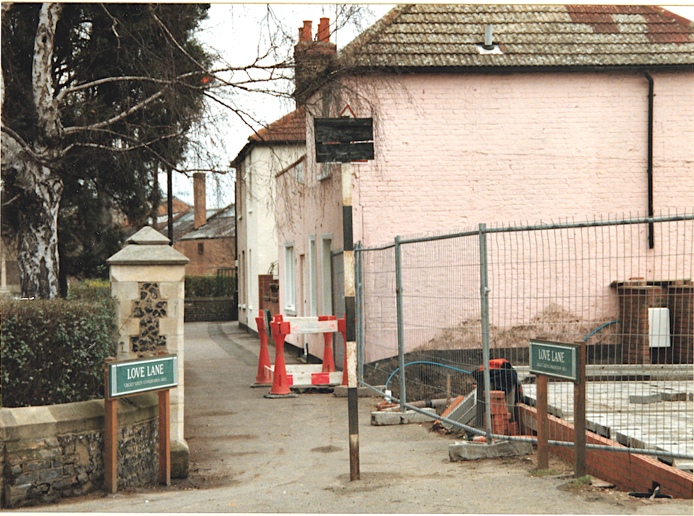
The last pub turned up by Mr. Chart was the Phoenix, first mentioned in 1838. It justified its name some years ago by rising out of its dead ashes as the Horse and Groom. Of the Sportsman, which formerly gave Dutch courage to those about to enter Love-lane, there is no official record at all. Which only shows you that the Vestry Clerk of that day, like the last of his line, was a gentleman of discretion.
If Mr. Gaston had been a member of the Fire Brigade Committee, or a follower of the statesman who urged all public per-sons to verify their references, he would not have “made the bloomer” of assuming that the Chief Officer was advocating the purchase of a foam generator like “the only one in London.” That is a machine the size of a motor pump and costing as much. Mr. Wells clearly stated in his report (in front of Mr. Gaston as he spoke) that the machine he had in mind would cost £75. He also clearly stated that his remarks and suggestions were “applicable to the storage of inflammable liquids that do not come within the provisions of the Petroleum Act.”
Now I say that as certain councillors do not come within the provisions of the Petroleum Act it is the duty of the rest to safeguard themselves and Mitcham by the purchase of a continuous foam extinguisher not generator. If one can be got for £75 and will prevent Coun. Groombridge, for instance, from bursting into flames more than fifty times at one meeting it will be a real economy to buy it.
THE COMMONER.
This text was extracted using Google’s AI Studio, model “Gemini 2.5 Pro Preview 03-25 gemini-2.5-pro-preview-03-25”, with the prompt “extract the text from this 1927 newspaper article” against the downloaded article image from the British Newspaper Archive.
Image © Successor rightsholder unknown. Please contact support@britishnewspaperarchive.co.uk if you wish to claim rights to this title.. Image created courtesy of THE BRITISH LIBRARY BOARD.