Following the road as it is currently numbered, it starts as a footpath off Church Road along the eastern side of the parish churchyard, and continues to Western Road.

1954 OS map showing the start of Love Lane at Church Road
Eric Montague, in his book, 12 Church Street and Whitford Lane, chapter 6, said that Love Lane almost certainly dated back to the Middle Ages as it served as the access lane to strips of land that stretched north of it. These strips were around a furlong, or 22 yards, in length, and the layouts of roads such as Frimley Gardens and Rodney Road to Fox’s Path, another access lane.
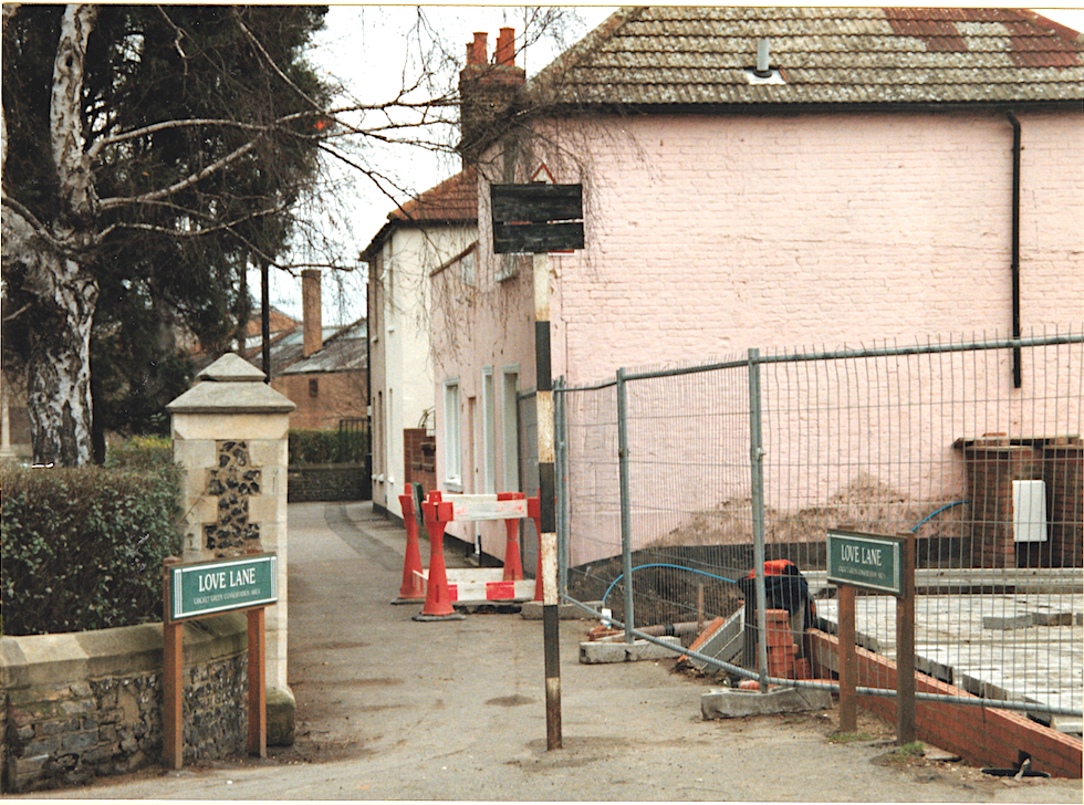
Entrance to Love Lane from Church Road. Photo taken when four 3-bed houses were being built on this corner by the Beaver Housing Society in 1996/7, which is now numbered as 82A Church Road.
In Love Lane, the houses with even numbers 2, 4 and 6 are on the right in the first part of the footpath, then 8, 10 and 12 are round the corner as the path heads east.
Then there is a block of four houses numbered 14, 16, 18 and 20, that have a datestone identifying it as Laburnum Cottages.
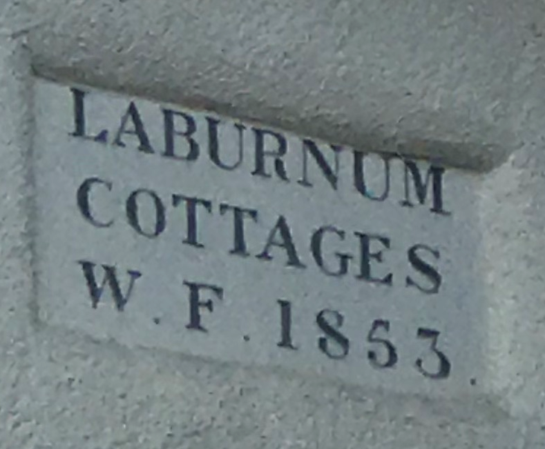
LABURNUM COTTAGES W. F. 1853
This block can be seen on this 1866 OS map:
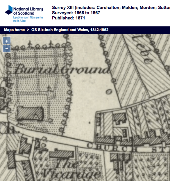
1866 OS map
After this block the footpath ends, and on the left is a terrace of 6 houses, numbered 1 to 11. This has a name plate in the middle, partially obscured by a drainpipe, which says ‘Hope Terrace’.
Opposite this terrace are houses built around 1983, as planning permission MER170/83 was granted on 21st April 1983. They are numbered with suffixes.
Next to these houses on the right side of Love Lane is a three storey block of 12 flats called Frimley House, which has numbers 22 to 44. Possibly built late 1930s or post-WW2 as the block is not shown on the 1933 OS map.
Opposite Frimley House, and past Hope Terrace, are two pairs of semi-detached houses, numbers 11A and 15, 17 and 19. Next to 19 is number 21, a detached house that is on the corner with Frimley Gardens.
After this the roadway turns right into Church Place but Love Lane continues as a footpath until Edmund Road. On the right can be seen the remains of the entrance to the council depot.
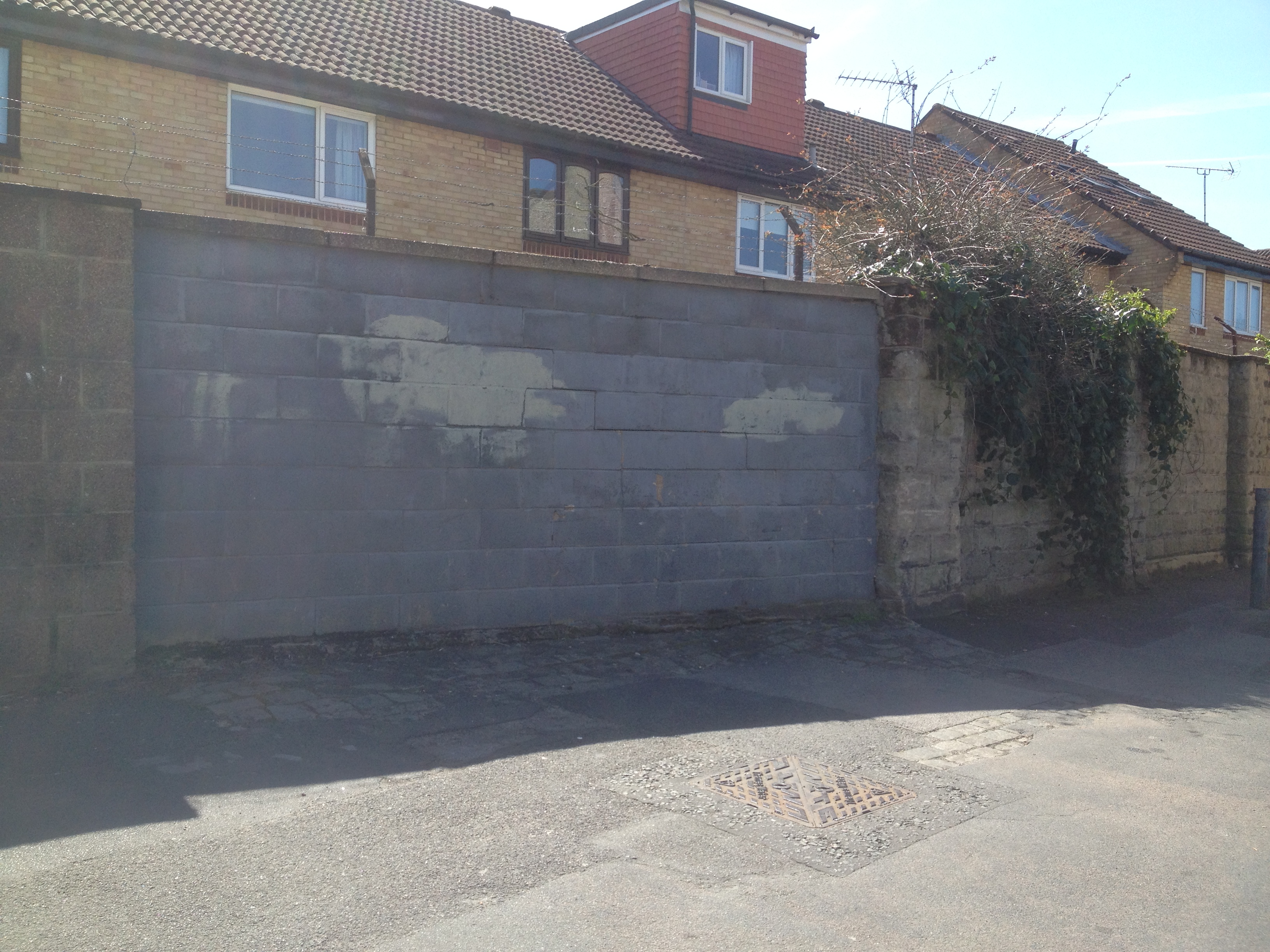
Breeze block filling where entrance to depot was. Photo taken 20th April 2016.
Past Harwood Avenue, the next houses on Love Lane are a pair of semi-detached on the left numbered 23 (Hope Cottage) and 25 (Rose Cottage). This is the only remaining pair of such cottages from those that were built in the early 19th century. The 1896 street directory describes walking from Church Street to Western Road, i.e. in a easterly direction, and the occupants were:
Samuel BEALES (Hope Cottage)
John HUSSEY (Rose Cottage)
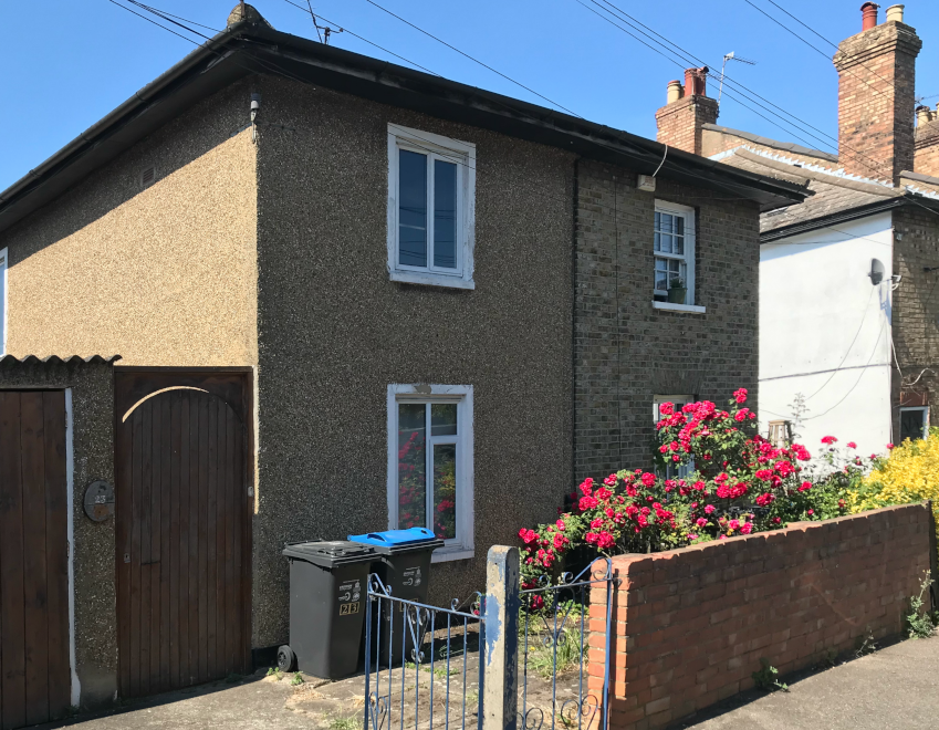
23 and 25 Love Lane. Photo taken 21st May 2020
Rose Cottage was the childhood home of William Henry SLATER, who emigrated to Australia in the late 1850s where he was one of the founders of the Mitcham township, now a suburb of Melbourne, Victoria.
This is followed by a terrace of 12 houses, numbered 27 to 49, which has the nameplate in the middle of ‘Douglas Cottages’. These were built in the first decade of the 20th century according to Montague, and were numbered 1 through 12, from west to east. In the 1915 directory Stewart Daniel SLATER, florist, is listed at no. 12.
Occupants of Douglas Cottages in the 1918 electoral register:
12, Charlotte and Stuart Daniel SLATER
11, Jane and Albert SIVIOUR
10, Annie Jane and Samuel James KING
9, Georgina and Philip Herbert Thomas CROWE
8, Emma Florence and George BRYANT
7, Sarah, Job and Herbert SMITH
6, Mary Ann and Richard MONERY
5, Alice and George BEADLE
4, Frederick WELLER
3, Eliza Harriet and Alfred Edwin HEDGER
2, George Edmund SMITH
1, Annie Elizabeth and George HINKLEY
from the Portsmouth Evening News – Thursday 20 January 1927, mentions 10-year old George CROWE of Douglas Cottages:-
TWO GIRLS RESCUED FROM DROWNING.
The plucky action of a 10-year-old Boy Scout, George Crowe, of Douglas Cottages, Mitcham, who rescued two girls who were in danger of drowning in the Thames at Kingston, was recognised at Kingston Police-court yesterday, when the Mayor (Dr. Finney) handed to Crowe a silver watch, the gift the Carnegie Hero Fund Trustees.
The Mayor stated that the two girls, Hilda and Ena Lisk, of Worcester Park, were bathing, and the elder girl tried to take her sister across the river on her back. When about 20 yards from the Middlesex bank the girls got into difficulties and sank. Without removing his clothes Crowe jumped into the water, and, after rescuing the younger girl, assisted the other one to the bank.
He had received the Scouts’ Silver Cross in recognition of his act. Expressing thanks for the gift, Crowe mentioned that he had received many letters of congratulation, including one from a lady in Smyrna.

1954 OS map
After Douglas Cottages is currently a nursery school, built in the early 1960s after a pair of semi-detached cottages, numbered 55 and 57, called Dent’s Cottages, was demolished. The Mitcham News & Mercury had an article in the 2nd September 1960 issue: 132-year old Love Lane cottage to come down.
Further along on the left hand side, after Dearn Gardens, are two detached houses that are set back from the road side at an angle, number 75 and number 77, the latter of which may have been called Glendene when it was occupied by George Victor DEARN, who developed Dearn Gardens.
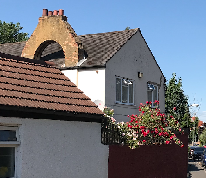
75 Love Lane with its arched chimney stacks. Photo taken 21st May 2020
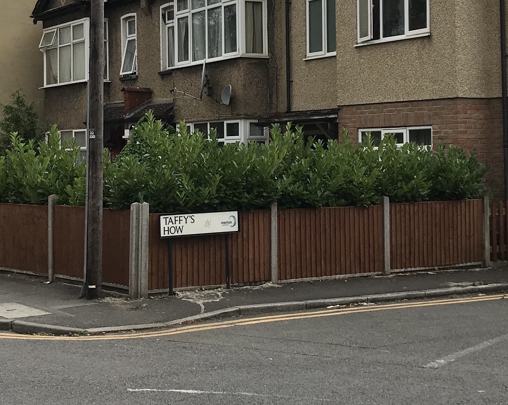
Next is a 3-storey block of 6 flats, numbered 79, 81, 83 and 79a, 81a, 83a. After which is a block of 2 houses, 85 and 87, with a third added on, number 89.
Corner of Love Lane and Taffy’s How shows no. 85, 87 and 89 Love Lane. Photo taken 15th July 2020
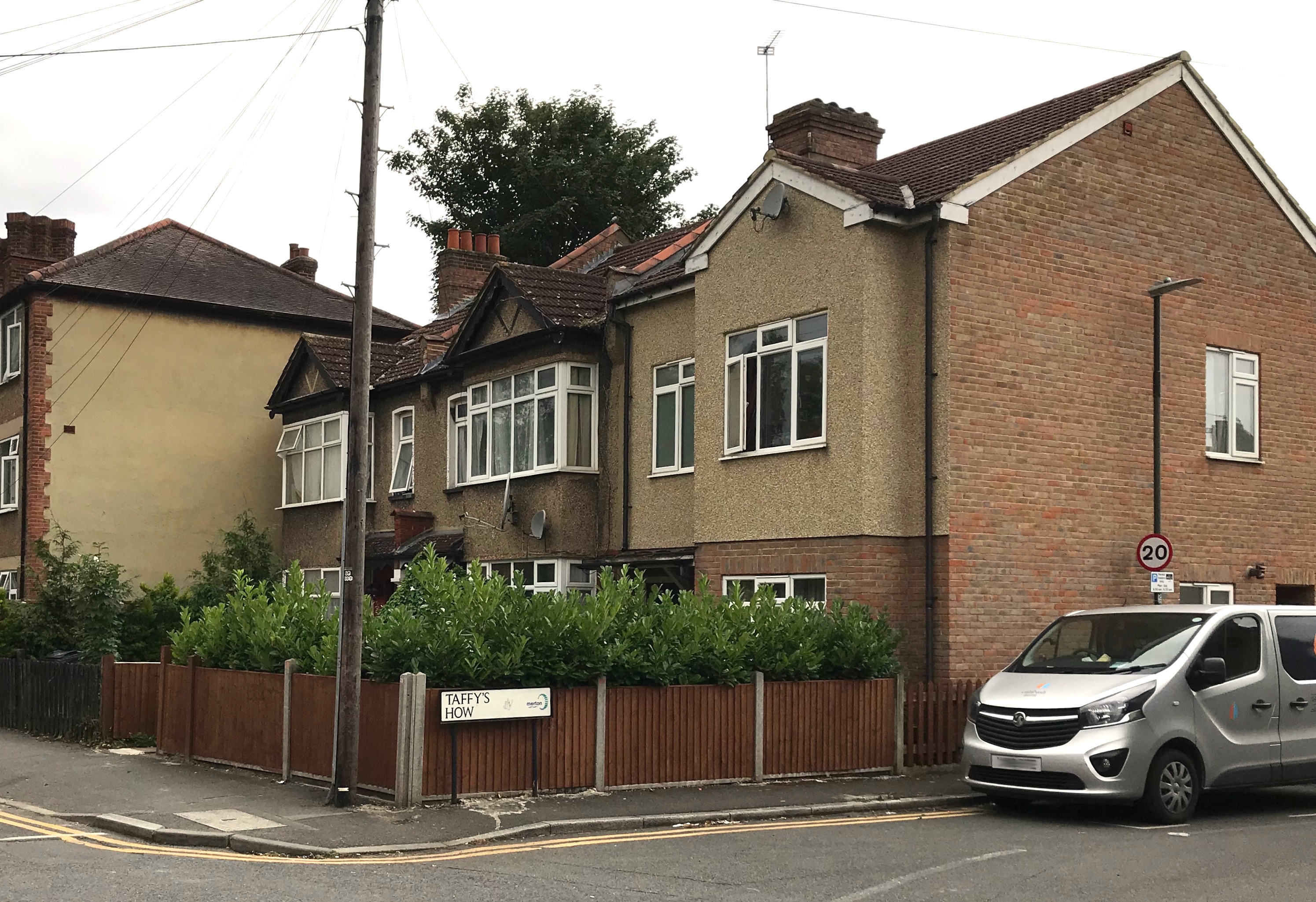
Houses numbers 103 to 121 were built in 1934 as part of the Pear Tree Close estate.
An older terrace of 4 houses, numbered 123 to 129, north of the corner with Westfield Road, dated from the 1880s, as are the similar houses on the north side of Westfield Road, according to Montague. The 1910-1911 street directory lists these houses as Knapdale Villas, with these occupants:
1, Frederick NEWSOM
2, Thomas ARTHUR
3, John HINCKLEY
A photo from around 1970 on Merton Memories, incorrectly labelled as Gladstone Road, shows these houses with their original slate roofs.

From Merton Memories, photo reference Mit_Streets_D_LEW_29-2
From the current footpath that leads to the Glebe Path and Queen Anne’s Gardens, on the right hand side of Love Lane northwards, were 6 pairs of semi-detached houses, five of which can be seen in this aerial photo from 1937.

1937 aerial photo from Britain From Above. Love Lane is on the right. Detached houses from right to left shown are numbers 100/102, 104/106, 108/110, 112/114, and 116/118.

No. 104/5. Clip of photo taken by Eric Montague in 1966. Reproduced by kind permission of the Merton Historical Society. Image reference mhs-em-wl-cr-9
Numbers 100/102 aren’t shown on this 1954 OS map, so may have been destroyed in the war. All six were demolished by the end of the 20th century and replaced by houses and bungalows.

1953 OS map reproduced by permission of the National Library of Scotland. Reuse CC-BY.
This 1910 OS map shows all 6 of the semi-detached houses.
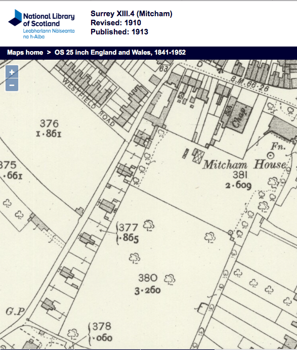
1910 OS map
In the 1925 street directory, these houses were numbered from the Western Road end, from 1 sequentially to 12.
1, William John UPTON
2, John BICKNELL
3, John CARRETT
4, George William SLATER
5, Samuel Henry BATEMAN
6, Arthur Goodwin FUNNELL
7, Mrs GEORGE
8, Henry James STEERS
9, Hoseph George WHITE
10, Henry DEARN
11, Hames Joseph GRACE
12, Leonard George FORTNAM
In the 1898 street directory, no. 6 was also known as Ivy Cottage and no. 7 as Jasmine Cottage.
Maps are reproduced with the permission of the National Library of Scotland.