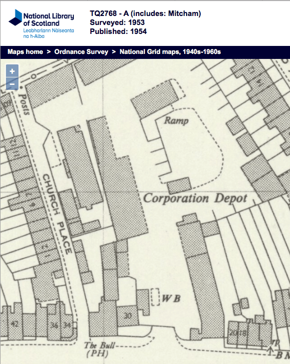
Cranmer Motors was a garage that was near the present day roundabout with Madeira Road and Cricket Green. Although the 1953 OS map shows it between 76 and 94 Cricket Green, Cranmer Motors Ltd was listed in the 1963 Mitcham Borough List of Factories as Motor Vehicle Repairs, 1 Cranmer Road.

1955 ad
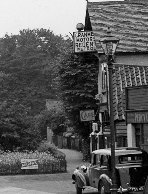
clip from Merton Memories photo reference Mit_Streets_Col_Cro_17-7, copyright London Borough of Merton, showing Cranmer Motors on garage
Cranmer
Motors
Regent
Petrol
This dates the photo to before 1967 which was when the Regent brand was changed to Texaco, according to Grace’s Guide to British Industrial History.
1953 OS map

Receipt from November 1992 for approx 10 gallons of petrol from the Cranmer Service Station.
The site was redeveloped as flats around 2008/9, as stated in planning application 06/P0708:-
Former Service Station Site, Cranmer Road, Mitcham, Surrey CR4 4LA
Erection of a part 2 / part 3 storey building to accommodate 12 flats (9 x 2 and 3 x 1 bedrooms) together with 12 car parking spaces.
Filed with this application:
Following air raid damage to residential properties during the Second World War, a garage forecourt replaced the destroyed houses on the study site, which by the 1970s was redeveloped as an Esso fuel filling station.
Source: Pre-Construct Archaeology Ltd. 2008 An Archaeological Watching Brief at the Former Esso Petrol Station, Cranmer Road, Mitcham, London Borough of Merton.
From the Mitcham Urban District Council minutes,
Volume 3, pages 104, Public Health and Burial Committee meeting of 11th September, 1917, a petrol licence for 150 gallons was issued to Mr G. Hart, Motor and Cycle Works, Cranmers Road.
Maps are reproduced with the permission of the National Library of Scotland.
Minutes of meetings held by the Mitcham Urban District Council are available on request from the Merton Heritage and Local Studies Centre at Morden Library.