Road that runs from the railway line at the Eastfields level crossing to Manor Road.
Scroll down or click the links to
Houses
Businesses
Newspaper Articles
Industry
World War 2
Maps reproduced by permission of the National Library of Scotland, reuse CC-BY.

1952 OS map showing numbers 2 to 20 at the western end of the road, next to the Eastfields level crossing.
Houses
The following is from Source: Mitcham Histories 3 Pollards Hill, Commonside East and Lonesome by E.N. Montague.
Numbers 2 to 8 were built about 1870, and were owned by the Allen family. They were known as the Sherbourne Cottages. No. 2 was known as Sherbourne House. These houses were blighted by the M23 motorway extension scheme and so were earmarked for demolition. Although the motorway scheme was abandoned, they were demolished in the 1980s.
This photo appears in Eric Montague’s book Mitcham Histories : 3 Pollards Hill Commonside East and Lonesome, on page 92.
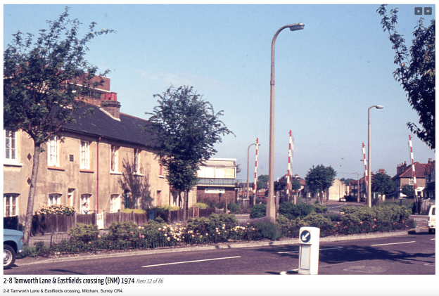
Photo taken by Eric Montague in 1974. Reproduced by kind permission of the Merton Historical Society. Image reference mhs-em-ph-l-12
In the 1925 street directory, the houses were numbered 1 to 4, Sherbourne Terrace:
1, Miss ALLEN
2, Frank SMITH
3, Arthur Edward HOBBS
4, Henry James MILLS
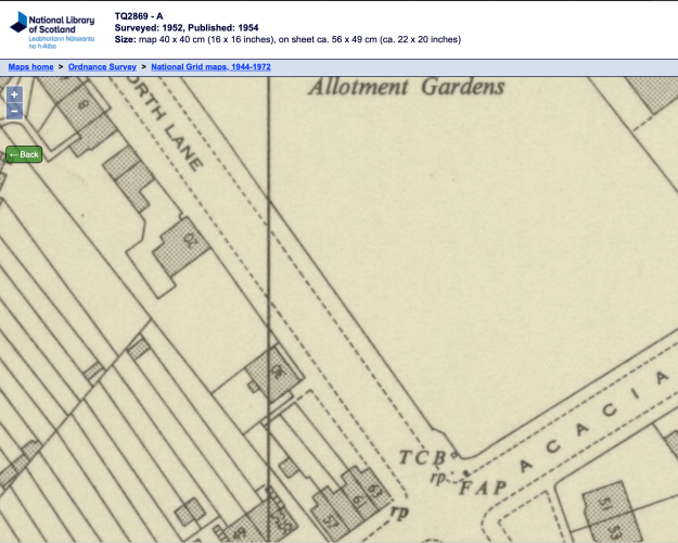
1952 OS map

Photo taken by Eric Montague in 1966. Reproduced by kind permission of the Merton Historical Society. Image reference mhs-em-ph-l-7
The photo appears in Eric Montague’s book Mitcham Histories : 3 Pollards Hill Commonside East and Lonesome, on page 93.
Number 30 was also owned by the Allen family.
The houses between Cedars Avenue and Tamworth Park, no.s 142 to 208, as shown on this 1952 OS map, were built by the Tamworth Park Construction Co., which is why they are of the same design as those at the northern end of Tamworth Park.

1952 OS map
On the north side of Tamworth Lane, numbers 231 to 241 and 243/5 were originally called Tamworth Cottages. These are now the only remaining late 19th century artisan’s houses left in this road.

Left to right: no.s 243 to 241. From Google Street View

No.s 243 and 245. From Google Street View.

1910 OS map
In the 1925 street directory, these houses were numbered 1 to 8 from east to west, hence no, 1 is now 245 and no. 8 is 231. The occupants in 1925 were:
(231) 8, James ROGERS
(233) 7, Mrs HEATH
(235) 6, Mrs COURTNELL
(237) 5, Charles Francis COURTNELL
(239) 4, Mrs COAD
(241) 3, Patrick McCARTHY
(243) 2, Robert William HAWKINS
(245) 1, Mrs HICKEY
Most of the houses along Tamworth Lane were built between the world wars. This ad from 1934 refers to those built by Crouch as the Crouch estate:

Streatham News – Friday 24 November 1933. Image © Successor rightsholder unknown.
These Crouch houses had an extra large kitchen with fitted cabinet with many cupboards, and recess for gas stove.

Streatham News – Friday 24 November 1933. Image © Successor rightsholder unknown.
Also in 1934, this ad from the builder Wates, refers to the Tamworth Gardens Estate:
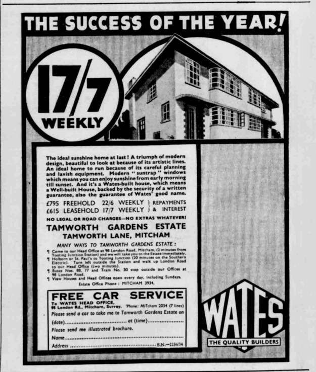
Ad from the Streatham News – Friday 22 June 1934
Image © Successor rightsholder unknown.
From the curved shape of the bays at the front, and the layout of windows at the side, my guess is that these houses were numbers 51 (at the corner with Acacia Avenue) to number 89.
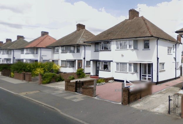
No. 83 and 85 part of the Tamworth Gardens Estate in Tamworth Lane. Photo taken 2008 by Google Street View.
Businesses
On the corner of the north side of Tamworth Lane and Manor Road stood the Horse & Groom pub until it was demolished in the late 1980s.
From the 1954 phone book:
No. 42, F. WILCOX, Fish fryer. MIT 4677
No. 48, L.M. LOVE, Greengrocer. MIT 2510
No. 297, J. HAWKER & Sons, Butchers. MIT 1545
No. 301, H.J. HIGHMAN, General stores. MIT 4735
Newspaper articles
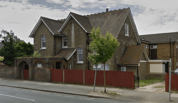
The Gables, from Google Street View, 2014
The Gables, 112 Tamworth Lane, was converted into 18 flatlets in 1960 as referred to in the following articles.
Mitcham News & Mercury 6th February 1959, page 9.
£20,000 flats plan.
A tender for the conversion of a house in Tamworth Lane, Mitcham, into 18 one-room flatlets for elderly people, has been accepted by Mitcham Council at a cost of £20,000.
Mitcham News & Mercury 13th May, 1960.
First tenants for new flatlets.
Work will be completed Saturday 14th May 1960 on The Gables, Tamworth Lane, Mitcham, where 18 old peoples’s flatlets have been built. The first tenants are expected to move in pm Thursday.
The flatlets have been built for old people to look after themselves. They consist of a bed-sitting-room, a kitchenette, and couples share the bathrooms and toilets.
Streatham News – Friday 20 October 1961 Image © Successor rightsholder unknown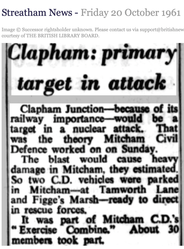
Industry
The Crown Chemical Works of Typke & King was on the south side of Tamworth Lane, between Barnfield Avenue and Marlowe Square.

1894 OS map

1894 OS map georeferenced with current OpenStreetMap
Hall & Co., gravel merchants, are the last entry in the 1925 street directory, see the gravel pit in the above 1894 OS map.
World War 2
Civilian deaths due to enemy action during the war. Click a name to go to the entry on the Commonwealth War Grave Commission website.
17th September 1940
No. 162, Dorothy Ruby PALMER, aged 37.
5th November 1940
No. 91, Florence Kate SIPPLE-ASHER, aged 46; Michael Joseph SIPPLE-ASHER, aged 49; Michelle Paula SIPPLE-ASHER, aged 19.
Victory Day Party
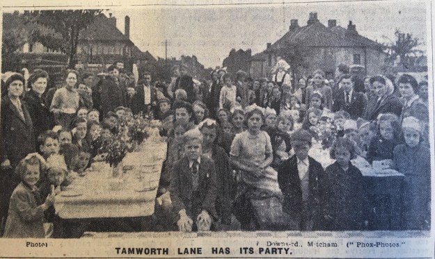
From the Mitcham News and Mercury, 22nd June 1945


