Cycle shop at 213 London Road (Buck’s Head Parade), from 1932 to 1968, which previously had been occupied by W.H. Jenner.
Listed in the 1938 commercial directory as Clarence Paget Dyne, cycle agent.

8th July 1954 ad
A comment on the Facebook Mitcham History group :
I worked at Dynes in 67. Mr Dyne used to have two shops, one in Battersea. After he died in 66 the Battersea shop was sold off… The Chinese moved in, in 68.
Chinese fast food shop Cheun Hong, can be seen in this 1987 photo on Merton Memories.
A 1959 photo on Merton Memories shows the advertising for Dyne’s on the north wall of Buck’s Head Parade. The words ‘Moped Service’ have been preserved as a ‘ghost sign’ with the mural of 2016.

2016 Ghost Sign

Photo taken 16th June, 2016
An ad from the East Mitcham Ratepayers Association magazine, dated October 1932, said that “Dyne’s of Clapham Junction” had acquired the business of the late W. H. Jenner.

October 1932
News for Mitcham!
DYNE’S
(of Clapham Junction) have acquired the business at 213 LONDON ROAD (Late W. H. Jenner)Stock Includes
RUDGE AND RALEIGH
CYCLESfrom 2/3 weekly
RADIO, GRAMOPHONES AND RECORDS
MOTOR CYCLE AND CYCLE REPAIRS
Official Rudge Sales and Service Depot
ACCUMULATORS CHARGED
Open Sundays Phone—MIT 2435
Notes
1. W.H. Jenner was listed in the 1925 street directory at number 5, Buck’s Head Parade.
2. A. & C. Jenner was listed at 5 Buck’s Head Parade in council minutes of 1916 for petroleum licences.
3. “2/3” meant 2 shillings and 3 pence. Decimalised, this is about 11p, and, adjusting for inflation, is equivalent to £7 in 2016.
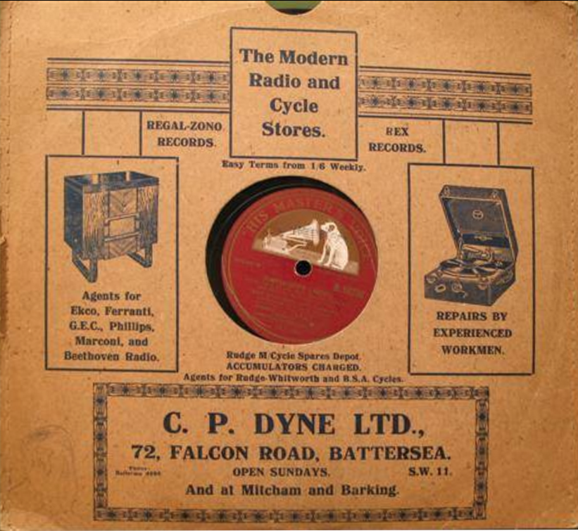
A photo of a record from the C.P. Dyne shop in Battersea, from Facebook:
Ad from 1914 for W. H. Jenner

1914
Shop also sold fishing tackle and bait, as shown in this ad from January 1963:
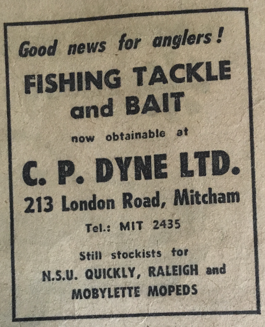
ad from January 1963