Rowan Terrace was a row of 8 cottages near Homewood Road, that were demolished in the 1930s.
The 1925 street directory gives details of how to find this terrace.
from 71 Church Road to Belgrave Road
South Side
Hawthorn Cottages: no.s 5,6,7,8
… here is Century Road
North Side
no.s 4,3,2,1
Benedict Terrace: no.s 1,2,3,4,5,6
… here is Rowan Terrace
… here is Homewood Road
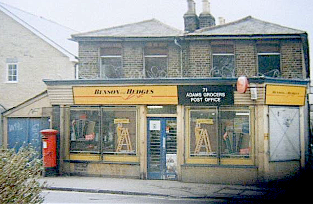
This 1952 OS map gives us house numbers, so the Post Office is number 71 (deduced from adjacent number 73).
A photo of this post office, from Facebook, confirms number 71 as a post office.

The alley at the side of the post office was known as Jessop’s Alley, later Adams or Adams’s Alley after the Adams family that ran the post office. ‘Adams Grocers’ can be seen on this photo.
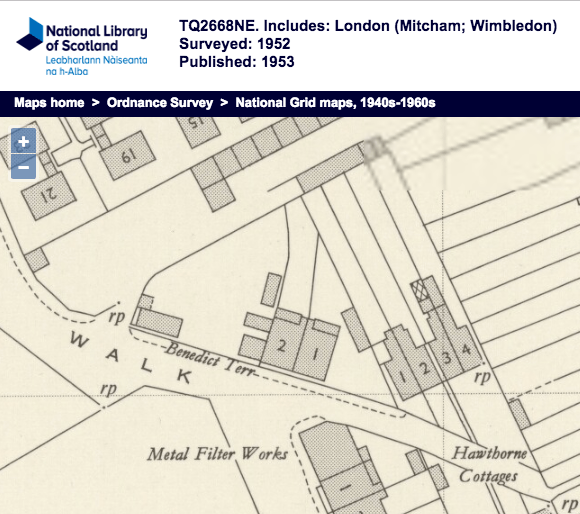
As Rowan Terrace is described in the street directory as being between Benedict Terrace and Homewood Road, this 1932 OS map shows a row of 8 buildings between the back gardens of Homewood Road and a footpath (marked as F.P. on the map).

1932 OS map
The 1934 Health Report identified this terrace as a clearance area. It says there were 8 cottages, which is the same number as seen on the 1932 map.
CLEARANCE AREA NO. 7.
Eight cottages known as 103, 105, 107, 109, 111, 113, 115, 117 Rowan Terrace. An objection having been made to this Order a local inquiry was held on April 24, 1934. The Order was confirmed.
Source: Report of the Medical Officer of Health for Mitcham, Wellcome Trust, page 33
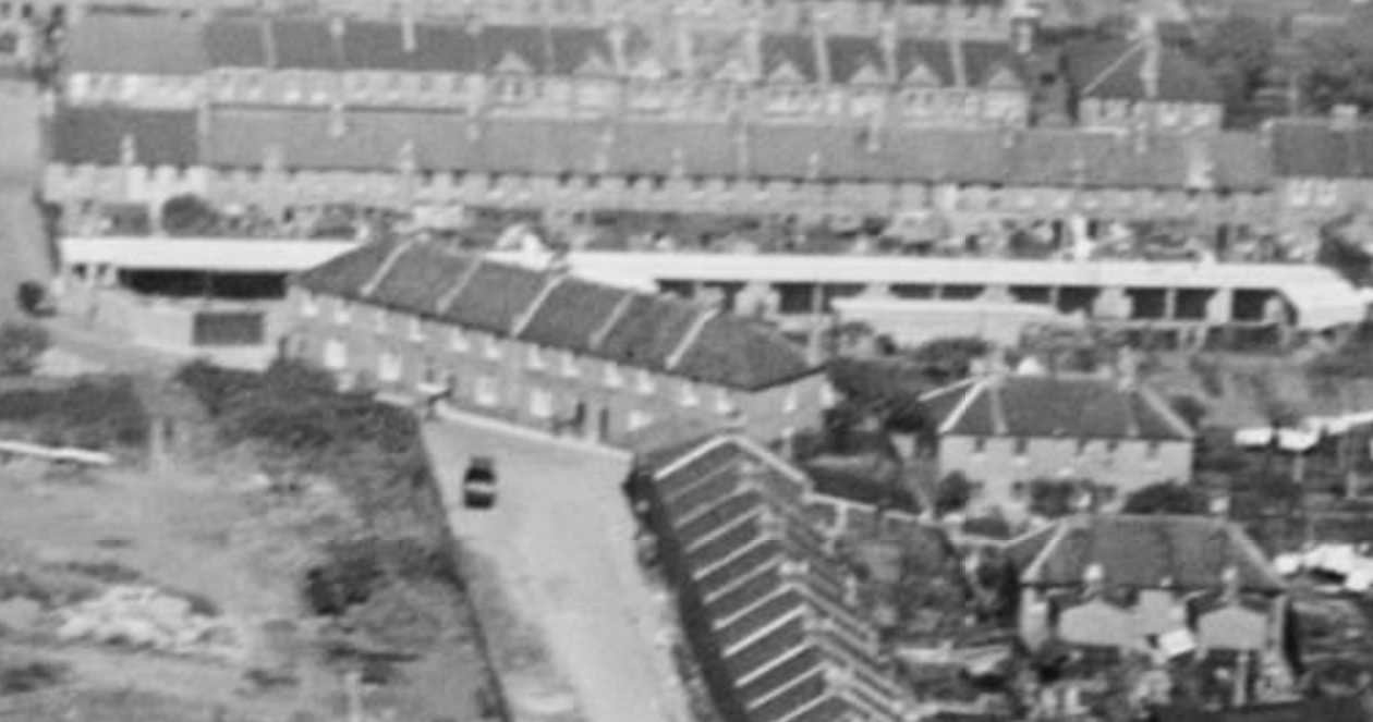
Garages were built on the site of Rowan Terrace. These can be seen in this aerial photo from 1937

1937