In 1882, the parish church’s burial ground was enlarged and a mortuary chapel was built by Crockett at a cost of £1,761, as referred to in an advertised tender in the Surrey Mirror. (Adjusted for inflation, this was the equivalent of around £200,000 today.)
An entrance from Church Road was made, opposite the post office (later 71 Church Road). A path from this entrance led to a circular path in front the chapel.
The new burial ground was consecrated on 15th January 1883 by the Bishop of Rochester.

zoomed in clip from 1947 aerial image on Britain from Above website
This 1910 Ordnance Survey map shows the entrance to the chapel as being opposite the letter box on the west side of Church Road. Another building is shown north east of the chapel, along the wall with Miles Road. The entrance that is there today is not shown and it is not known whether this building was related to the mortuary chapel.
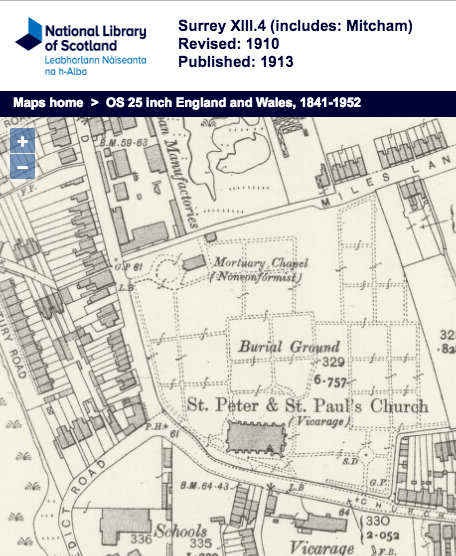
1910 OS map
When Mitcham became part of the London Borough of Merton in 1965, the Coroner decided that autopsies and inquests would be performed at Battersea for both Merton and Wandsworth. This decision was recorded in the minutes of the Parks, Cemeteries and Allotments Committee dated 26th May 1965:
612. Mitcham and Wimbledon Mortuaries
The Director of Parks reported
(i) that following the reorganisation of the London boroughs, H.M. Coroner had decided that as from the 1st April, 1965, he will hold all inquests for both the London boroughs of Merton and Wandsworth at the Battersea Coroner’s Court and that consequently all autopsies on bodies will be carried out at the Battersea Mortuary; and
(ii) that no request has been made to use the Wimbledon and Mitcham mortuaries which had been kept in readiness since the 1st April in case local funeral directors wish to use them as Chapels of Rest, and
(iii) that consequently there seemed to be no necessity to keep the mortuaries available particularly as some financial arrangements would have to be agreed with the London Borough of Wandsworth for bodies admitted to the Battersea Mortuary from this borough.
Source: Minutes of proceedings of the council and committees, London Borough of Merton Council Minutes, 1965-66, volume 2, part 1.
On page 68 of Mitcham Histories: 12 Church Street and Whitford Lane, by the late Eric Montague, is a photograph of the building he took around 1990. The colour version of this photo can be seen on the Merton Historical Society’s website, although it says that it was taken in the 1970s.
Today, nothing is left of the chapel building, although the circular path remains. It is currently not known when it was demolished.
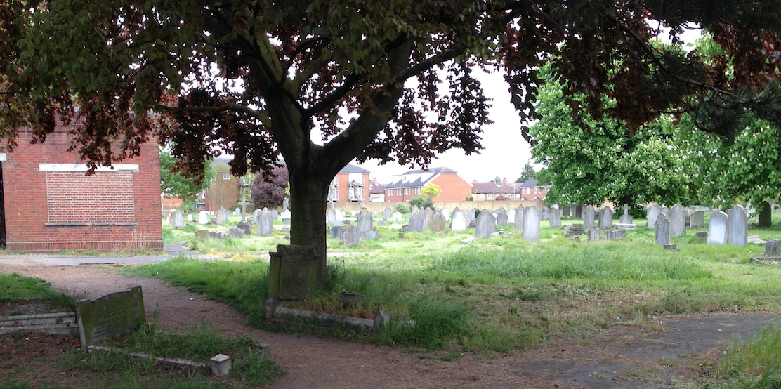
Photo taken 26th April 2017 of plot where mortuary chapel once stood.
Measurements made using the online map show the length of 45 feet along its east-west side, and its depth of 30 feet along its north-south side.
Inquests were held at the Mortuary Chapel. Here are links to some newspaper articles that reported them.
1895 Death from pleurisy
1910 Miss Ellen Peerless, of the Ship Laundry
Maps are reproduced with the permission of the National Library of Scotland.
Minutes of meetings held by the London Borough of Merton are available on request from the Merton Heritage and Local Studies Centre at Morden Library.


