Smith’s Terrace was a block of six shops and flats, on the west side of London Road, at the north corner of Bond Road. In the 1911 commercial directory, they were numbered sequentially from 1 to 6, from north to south. Numbers 1 & 2, and 5 & 6 were two-storey, with 3 & 4 in the centre having 3 storeys.
This clip shows ‘Smiths Terrace’ on a stone plaque in the centre building of the terrace.
Clip from Merton Memories photo reference Mit_Streets_Lon_38-37, copyright London Borough of Merton
This OS map from 1911 shows the terrace on the left hand side of the London Road, which had tram lines. The Swan pub can be seen to the north. The ‘LB’ refers to a letter box which is mentioned in the street directory below.

1911 OS map
From the 1914 street directory, going south on the west side of London Road:
PILLAR LETTER BOX
SMITH’S TERRACE:
1 Frederick STANNET, grocer
2 William CHANCE, laundry
3 Mrs HALLIDAY
4 Thomas William MOSS
5 THOMPSON & Son, dairy
6 Mrs. Minnie McNAUGHTON, beer retailer……. here is Bond rd ……
Number 6 Smith’s Terrace, on the corner with Bond Road, was The Ship pub up until the mid 1930s.
The 1915 directory has Frederick STANNETT, baker at 7 Station Parade and grocer at number 1.
After renumbering, the terrace became numbers 190 to 200, even, from north to south, with 200 at the corner, as summarised below:
| Old number> | New number |
|---|---|
| 1 | 190 |
| 2 | 192 |
| 3 | 194 |
| 4 | 196 |
| 5 | 198 |
| 6 | 200 |
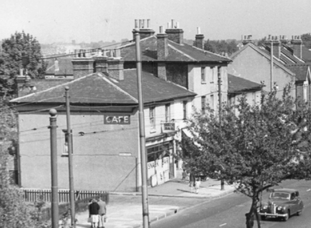
1950s view of Smiths Terrace from Elm Court in Armfield Crescent.
The ‘GP’ shown in this 1952 OS map is a ‘Guide Post’, or direction sign. In the clip above showing the plaque, this direction sign shows A217 straight ahead to Tooting and A216 to Streatham.

1952 OS map
Aerial photo from 1953:

1953 aerial photo from Britain From Above
These photos show parts of the terrace being demolished in the early 1970s.

1973 photo looking south, with no. 200 on left. Image courtesy of Collage – The London Picture Library – http://collage.cityoflondon.gov.uk

1973 photo showing no. 200 on left at corner with Bond Road. Image courtesy of Collage – The London Picture Library – http://collage.cityoflondon.gov.uk
As of March 2018, number 190 still stands, which was Eddowns car spares shop. It will probably be redeveloped as flats.
Maps are reproduced with the permission of the National Library of Scotland.
