Road off east side of Bramcote Avenue, both of which were built in 1935 on land that had been the market gardens of Mr W. Carlton.
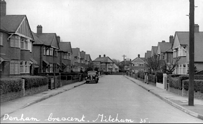
possibly taken in 1935 after the road had been built – the view is looing south along the longest part of the road
Google StreetView of the road:
The road is a square rather than a crescent, as can be seen in this 1954 OS map.
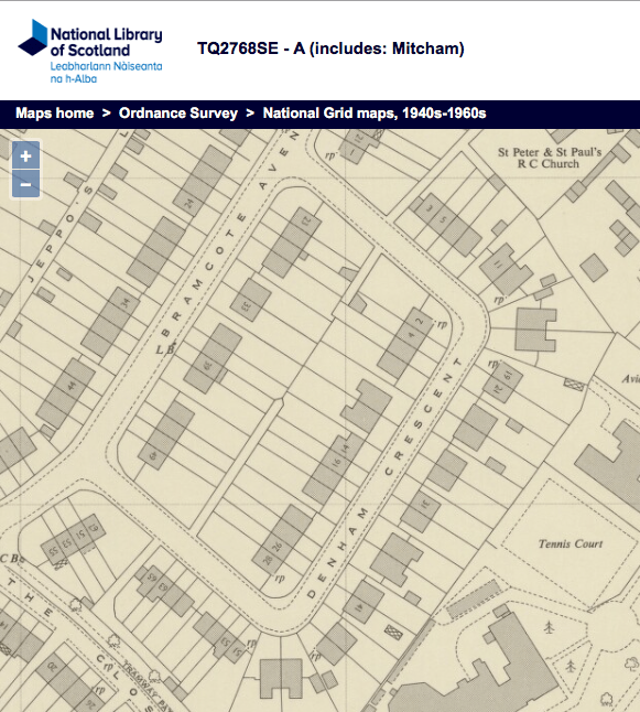
1954 OS map
The houses are numbered odd, from 1 to 67, on the outer part of the square, and even from 2 to 28 on the inner part. The first house, no. 1, and the last house, no. 67, are physically attached to terraces in Bramcote Avenue, with the entrance door facing Denham Crescent. Odd numbered houses all have the postcode CR4 4LZ, and the even numbered houses have CR4 4LY.
The pair of semi-detached houses in the south corner, no.s 47 and 49, were demolished and a smaller pair built allowing access to a new road, called Canons Close, two pairs of semi-detached houses. Planning application 09/P2248, which had around a dozen objections, was given permission on 25th June 2010:
Demolition of existing properties at 47-49 Denham Crescent and the construction of 6, four bedroom semi detached houses with accommodation over 2 storeys and the roofspace including a pair of properties adjacent to 45 Denham Crescent with a new road providing access to four semi detached properties at the rear of the site.
The houses in Canons Close all have the postcode CR4 4FJ.
Maps are reproduced with the permission of the National Library of Scotland.
