Pub rebuilt in 1910.
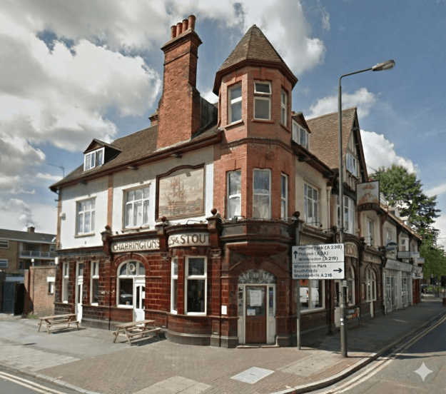
2012 Google Street View
Location:15 Merton High St, London SW19 1DF
I. ORIGINS & FOUNDATION (Early 19th Century)
1829 | Establishment
- Foundation: The Nelson Arms is established, planting deep historical roots in the local area.
- Context: It emerges during a period of dense licensed trade along the High Street, driven by industrial employment and transit traffic.
II. THE EDWARDIAN REINVENTION (1905 – 1910)
1905 | The “Local Hero” Context
- Cultural Atmosphere: The centenary of Lord Nelson’s death is celebrated locally with reverence.
- Significance: He remains a “local hero” to the community, influencing the pub’s strong thematic identity.
1910 | The Grand Rebuild
- Event: The pub is completely rebuilt.
- Significance: This reconstruction transforms the building into a specialized “Nelsonian” landmark rather than a generic public house.
III. ARCHITECTURAL DISTINCTION (1910 – Present)
The “Garters” Murals
- Feature: The exterior is adorned with iconic tiled murals depicting Lord Nelson and HMS Victory.
- Artistry: These distinctive ceramics are attributed to “Garters of Poole”.
- Impact: The murals turn the pub into a destination for architectural tourism, distinguishing it from its competitors.
IV. RESILIENCE & SURVIVAL (Modern Era)
Late 20th Century | Survival of the Fittest
- Contrast: While the King’s Head converts to offices and the Royal Six Bells closes due to flooding, the Nelson Arms survives the erosion of the traditional pub network.
- Strategy: Its specialized branding and unique architectural identity provide the resilience needed to withstand market pressures.
Present Day | A Living Landmark
- Status: The Nelson Arms remains a functioning public house.
- Legacy: It stands as a “Tiled Success Story” and a tangible link to the area’s historical density of licensed trade.
Maps
Ordnance Survey maps are reproduced by permission of the National Library of Scotland, reuse CC-BY.
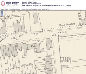
1894 OS map
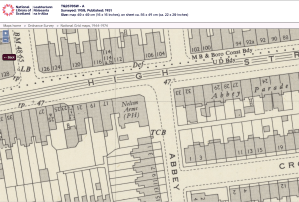
1950 OS map
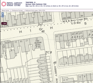
1960 OS map