Garage that was on the west side of Nursery Road. Proprietor James STEVENS.
The earliest ad found in the Mitcham Advertiser is from 1924.
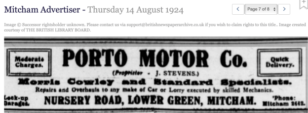
Mitcham Advertiser – Thursday 14 August 1924 Image © Successor rightsholder unknown.
The latest ad for Nursery Road was in 1928:
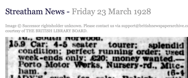
Streatham News 23rd March 1928 ad
At some point between 1928 and 1931 the business moved to the corner of Wandle Road and Bishopsford Road, where the Esso petrol station is now. This petrol station still has the same phone number 020 8648 0856, shown in the 1934 ad below as Mitcham 0856.
This news item from 1931 shows that the business had moved from Nursery Road, and also that James Stevens lived in Edmund Road.
Streatham News – Friday 25 September 1931
ALLEGED ATTEMPT AT HOUSE-BREAKING
THREE MEN REMANDED
Three smartly-dressed young men appeared in the dock at Croydon County Police Court on Tuesday, charged with alleged attempted housebreaking.
They were William Hale (23), greengrocer, of Lyham-road, Brixton; Leslie Hurburgh (20), salesman, of Norbury-hill, Norbury, and Charles Ransom (21), clerk, of no fixed abode, and the charge was that they attempted, at 11.15 p.m. on Monday, to break into a lock-up shop and a garage at the Porto service station, Bishopsford-road, Mitcham, belonging to James Stevens, of Edmund-road, Mitcham.
P.C. Beales, who was on motor patrol duty, gave evidence that on Monday he was instructed to keep observation for a Morris car. He saw the car in Bishopsford-road. It was close to the kerb, twenty yards from the side of the garage. He passed it, went down the road for 200 yards, and returned and stopped his car immediately in front of the other car. Hurburgh was sitting in the driving seat of the car and Hale in the rear seat. He said to Hurburgh “Why are you staying here?” He replied “The official is gone.”
Witness then saw Ransome come from the Porto garage, and as he approached he threw something over the wooden fence adjoining the footpath. It landed on the ground with a metallic ring. Witness told prisoners they had acted in a suspicious manner, and he took them to Mitcham police station. When he returned witness found a screwdriver and file on the ground, and that an attempt had been made to force the office door of the garage, marks corresponding in width with the blade of the screwdriver, which also bore marks of red brick. An attempt had also been made to open a lock-up garage with a wider instrument, a piece of wood having been wrenched off the door.
The three accused were remanded for a week, and bail was not allowed.
It may have become a petrol station in 1933, as shown in this news item about Mr J. Stevens writing to the Council for a draw-in near petrol pumps.
Mitcham Advertiser – Thursday 30 November 1933
GARAGE NEEDS. Mr. J. Stevens, of the Porto Service Station, had written concerning the Council’s refusal to permit him to use a portion of the back of the public footpath in Bishopsford-road to make a draw-in near petrol pumps. The Surveyor had investigated the matter and was directed to report to the General Purposes Committee on the County Surveyor’s observations on a proposal to widen the carriage-way so as to enable petrol to be supplied to cars in the road.
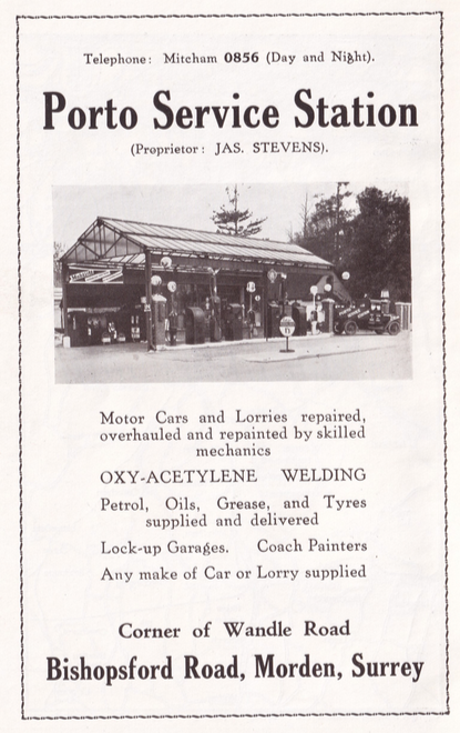
1934 ad
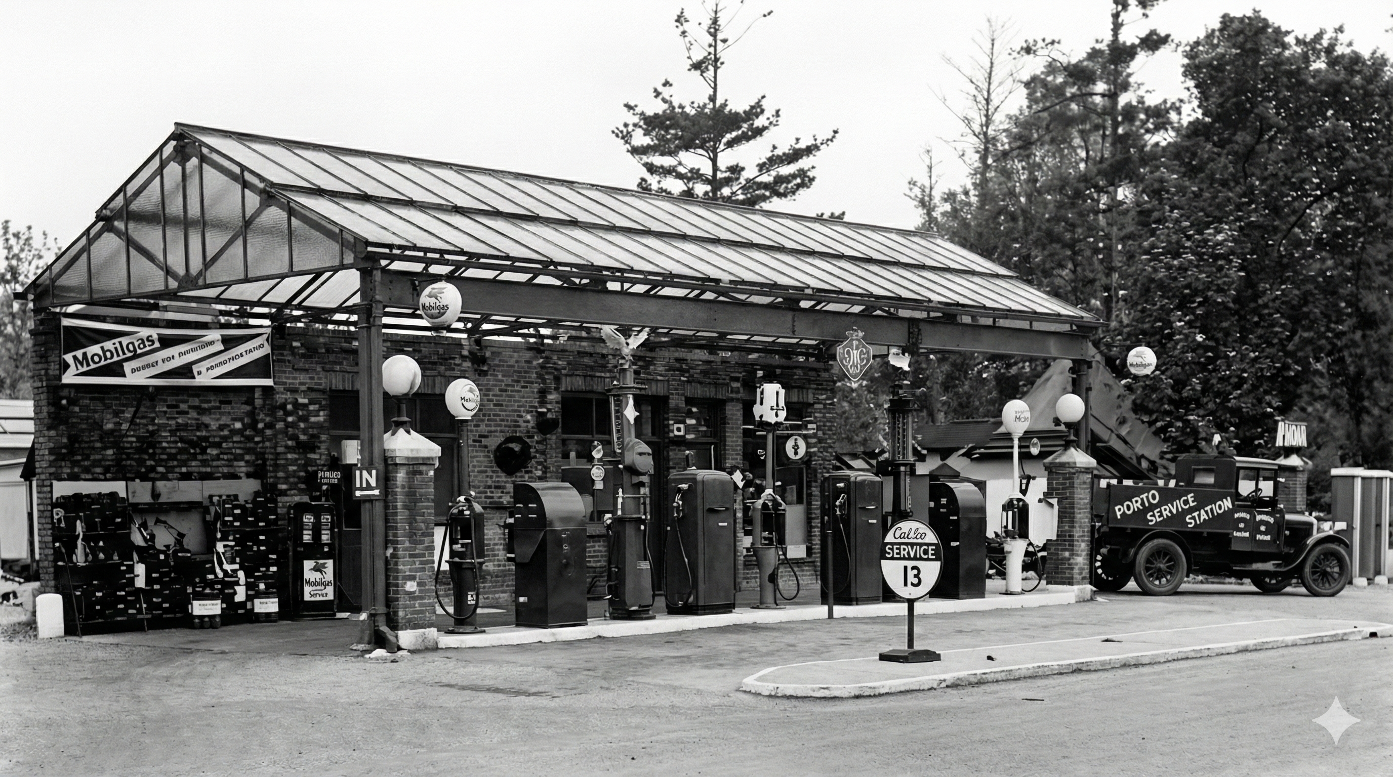
Upscaled photo from 1934, using Google Nano Banana Pro
In the 1954 and 1971 phone books, the petrol station was Blue Star Garages Ltd.
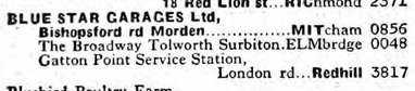
1954 phone book