New road with housing off east side of Tamworth Park, north of Commonside East and south of Tamworth Lane. The road is parallel to Tamworth Park. There are 33 properties in this road, numbered consecutively from 1 to 33, all with the postcode CR4 1JQ.

aerial view looking towards the east
Possibly built in 1988 or 1989. Planning permission 88/P1199 was applied for in 1988 for Numbers 54/56 and land and premises rear of numbers 2-52, Tamworth Park, Mitcham
for the redevelopment of site by the erection of 6 x three bedroom houses 6 x three bedroom flats 12 x two bedroom flats and 19 x one bedroom flats together with associated parking and landscaping. This application was refused and an appeal was lodged, with that being refused as well. The LB Merton planning website doesn’t however show the application that was allowed for the current development, which is of 4 blocks, 2 of flats, and 2 terraces of houses.
This 1910 OS map shows that a field, numbered 268, of 1.182 acres, where Worthington Close is now.

1910 OS Map
The Tithe Apportionment Map of 1846 shows that this field was part of the land owned by John Watney.
The 1938 OS map shows a cluster of buildings at the north end of this field.
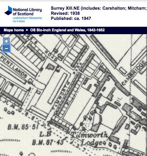
1938 OS Map
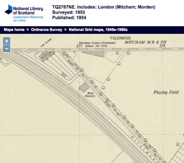
The 1953 OS map helps to identify these buildings:
1953 OS map
On the map, there is one building with a number: 54. The houses in Tamworth Park are numbered to 52 before the access road to these buildings, and 56 after, so the address of this is 54 Tamworth Park. This was the address of the Tamworth Park Construction Company, which built Tamworth Park. It was owned by Joseph Owen, who donated the land for the
Mitcham Library.
Other occupants of 54 Tamworth Park included the company Hyrax Lubricants Ltd., which applied for a trademark in 1940 for its product “Hyrax-Petrecon”.
Planning application MIT1836, dated 21st December, 1955, has a B.S. Bartlett of 54 Tamworth Park being permitted use of part of 54 Tamworth Park for a garage and motor repair business. It is believed that this property continued to be used for car repairs until the mid 1980s (from a comment on the Facebook Mitcham History Group).