Tag Archives: Lower Green West

Queen Anne’s Bounty

To help with the income of poor clergy, the Queen Anne’s Bounty was a sum of money used to buy land. This land was then rented out and this rental income was used to support the clergy.

In 1734, £200 of this Royal Bounty was used to buy an area of land from Charles Dubois in Mitcham, to support the vicar at the parish church.

Source: An Account of the Augmentation of Small Livings by “The Governors of the Bounty of Queen Anne for the Augmentation of the Maintenance of the poor Clergy” published in 1856, by Christoper Hodgson, M.A.

Source: An Account of the Augmentation of Small Livings by “The Governors of the Bounty of Queen Anne for the Augmentation of the Maintenance of the poor Clergy” published in 1856, by Christoper Hodgson, M.A.

Eric Montague, in his Mitcham Histories : 12 Church Street and Whitford Lane, page 107, said that more land was bought in 1762 from Mary Gellibrand.

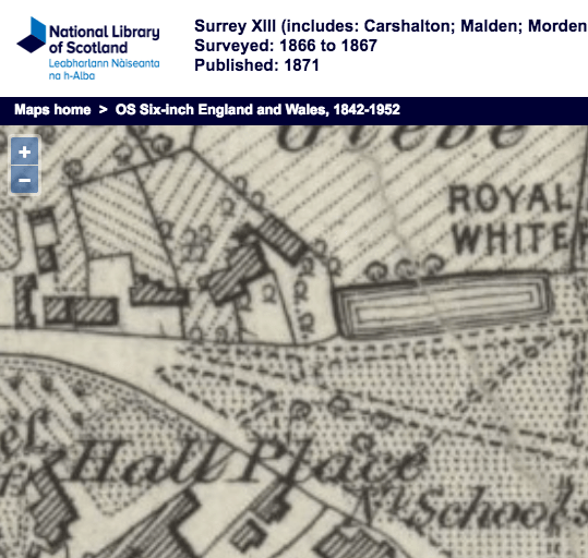
This OS map of 1867 shows areas marked as ‘Glebe’. Note that the London Road was, as shown on this map, known as Whitford Lane.

1867 OS map

1867 OS map

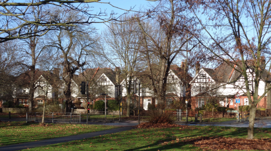
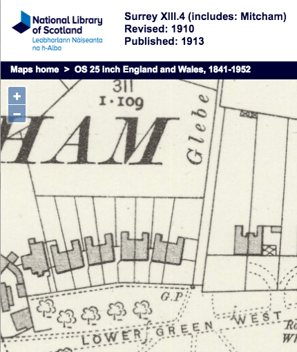
Later, parts of this land was sold off to developers to build houses. Montague, page 108, ibid., said that in 1790 a substantial plot was sold to build a house which became Glebelands.

In the Land Registry title for a house in Preshaw Crescent for example, a conveyance was made in 1897:

A Conveyance of the land in this title and other land dated 2 September 1897 made between (1) The Reverend Frederick Wilson Clerk (the Incumbent) (2) The Governors of The Bounty of Queen Anne for the Augmentation of The Maintenance of The Poor Clergy (the Governors) (3) The Right Reverend Father in God Edward Stuart (the Ordinary) (4) Francis Charles Simpson (the Patron) (5) The Right Honourable and Most Reverend Frederick By Divine Providence Lord Archbishop of Canterbury (the Archbishop) and (6) Richard Arthur Bush (the Purchaser) contains covenants details of which are set out in the schedule of restrictive covenants hereto.

See also Queen Anne’s Bounty on wikipedia.


Maps are reproduced with the permission of the National Library of Scotland.

Preshaw Crescent

Photo taken 2nd January, 2017

Photo taken 2nd January, 2017

Photo possibly taken after the houses were built.

Photo possibly taken after the houses were built.

A row of four pairs of houses from the corner with Glebe Path running west, in parallel with, but set back from, the north side of Lower Green West. Built after 1897 on the site of a pond, which is shown in this 1866 map:

1866 OS map

1866 OS map

According to Eric Montague in his book Mitcham Histories: 5 Lower Green West, page 11, the pond measured 200 feet by 50 feet and had been called King’s Pond. The sub-soil here is sand and gravel and Montague suggested that this was originally a pit dug for the gravel, which would be used in building. With the water table high the pit would have filled in with water forming the pond.


The year of 1897 comes from the Land Registry title for number 6, which was auctioned in early 2016:

A Conveyance of the land in this title and other land dated 2 September 1897 made between (1) The Reverend Frederick Wilson Clerk (the Incumbent) (2) The Governors of The Bounty of Queen Anne for the Augmentation of The Maintenance of The Poor Clergy (the Governors) (3) The Right Reverend Father In God Edward Stuart (the Ordinary) (4) Francis Charles Simpson (the Patron) (5) The Right Honourable and Most Reverend Frederick By Divine Providence Lord Archbishop of Canterbury (the Archbishop) and (6) Richard Arthur Bush (the Purchaser) contains covenants details of which are set out in the schedule of restrictive covenants hereto.

The restrictive covenant contained in the conveyance of 2nd September 1897 stated that …

the purchaser would within 12 months of the date of abstracting presents erect not less than 4 detached houses or two pairs of semi detached houses on the premises.

That no buildings other than dwelling houses with their offices should be erected on the premises the prime cost of which for work and materials should not be less than £400 or in case of pairs of semi-detached dwellinghouses should not be less prime cost than £650 per pair.


This 1910 OS map shows the four pairs of houses:

1910 OS Map

1910 OS Map

Occupants

From the 1915 street directory:

Lower green west, from London Road
NORTH SIDE

… here is Glebe Path
PRESHAW CRESCENT:
1, Charles STUART
3, George Henry NELSON
4, Robert CHART
5, Arthur LANGRISH
7, Charles Clarke APLIN
8, John David CLARKE

From the 1925 street directory:

Lower green west, from London Road to Church Road
WEST SIDE

PRESHAW CRESCENT:
1, Charles STUART
2, Miss Bessie May MARTIN
3, George NELSON
4, John William ALLEN
5, Arthur LANGRISH
6, Charles R SINCLAIR
7, Mrs HOLLIS
8, Herbert E HART
9, George W.T. ORMOND

Note that number 9 is possibly the White Cottage.


Maps are reproduced with the permission of the National Library of Scotland.