Author Archives: Wade

Love Lane

Following the road as it is currently numbered, it starts as a footpath off Church Road along the eastern side of the parish churchyard, and continues to Western Road.

1954 OS map showing the start of Love Lane at Church Road

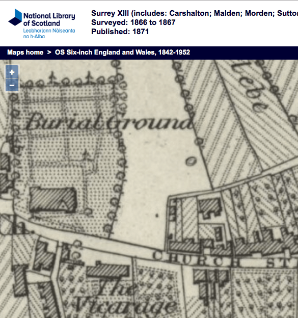
Eric Montague, in his book, 12 Church Street and Whitford Lane, chapter 6, said that Love Lane almost certainly dated back to the Middle Ages as it served as the access lane to strips of land that stretched north of it. These strips were around a furlong, or 22 yards, in length, and the layouts of roads such as Frimley Gardens and Rodney Road to Fox’s Path, another access lane.

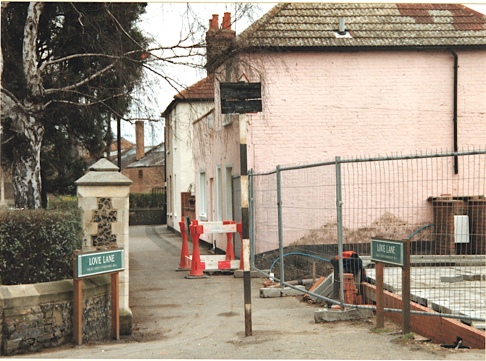
Entrance to Love Lane from Church Road. Photo taken when four 3-bed houses were being built on this corner by the Beaver Housing Society in 1996/7, which is now numbered as 82A Church Road.

In Love Lane, the houses with even numbers 2, 4 and 6 are on the right in the first part of the footpath, then 8, 10 and 12 are round the corner as the path heads east.

Then there is a block of four houses numbered 14, 16, 18 and 20, that have a datestone identifying it as Laburnum Cottages.

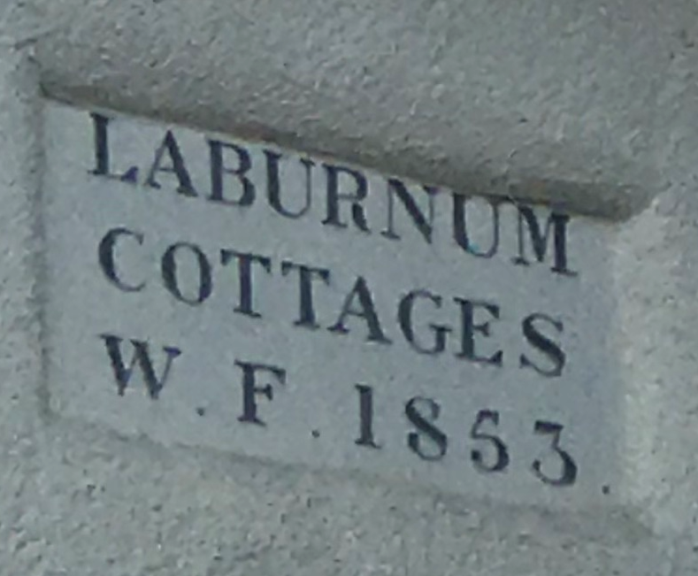
LABURNUM COTTAGES W. F. 1853

This block can be seen on this 1866 OS map:

1866 OS map

After this block the footpath ends, and on the left is a terrace of 6 houses, numbered 1 to 11. This has a name plate in the middle, partially obscured by a drainpipe, which says ‘Hope Terrace’.

Opposite this terrace are houses built around 1983, as planning permission MER170/83 was granted on 21st April 1983. They are numbered with suffixes.

Next to these houses on the right side of Love Lane is a three storey block of 12 flats called Frimley House, which has numbers 22 to 44. Possibly built late 1930s or post-WW2 as the block is not shown on the 1933 OS map.

Opposite Frimley House, and past Hope Terrace, are two pairs of semi-detached houses, numbers 11A and 15, 17 and 19. Next to 19 is number 21, a detached house that is on the corner with Frimley Gardens.

After this the roadway turns right into Church Place but Love Lane continues as a footpath until Edmund Road. On the right can be seen the remains of the entrance to the council depot.

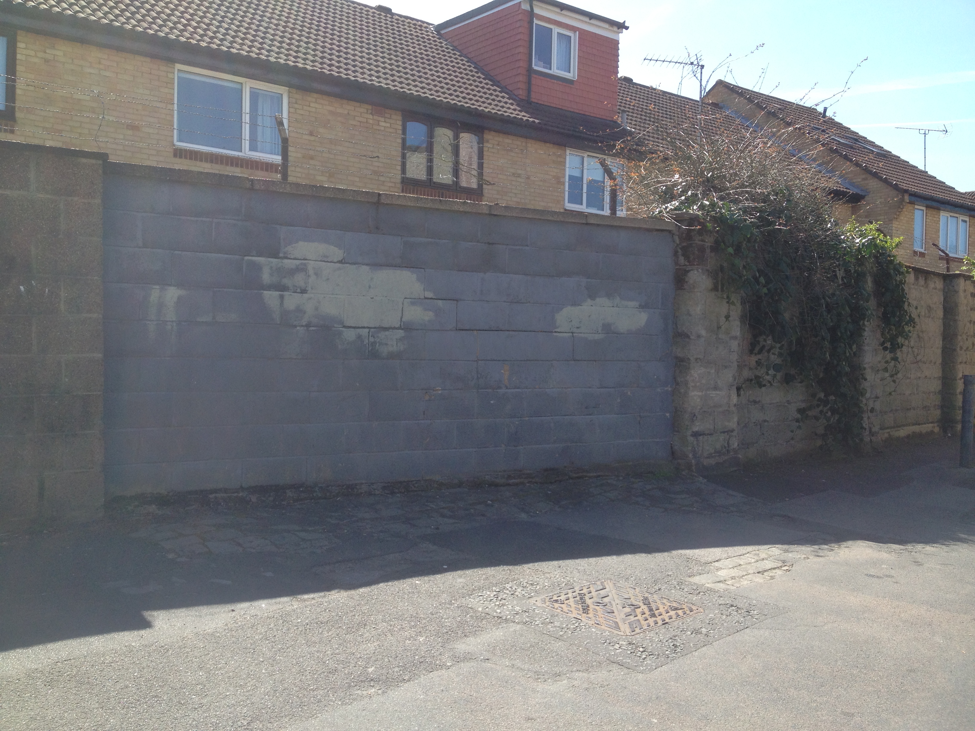
Breeze block filling where entrance to depot was. Photo taken 20th April 2016.

Past Harwood Avenue, the next houses on Love Lane are a pair of semi-detached on the left numbered 23 (Hope Cottage) and 25 (Rose Cottage). This is the only remaining pair of such cottages from those that were built in the early 19th century. The 1896 street directory describes walking from Church Street to Western Road, i.e. in a easterly direction, and the occupants were:

Samuel BEALES (Hope Cottage)
John HUSSEY (Rose Cottage)

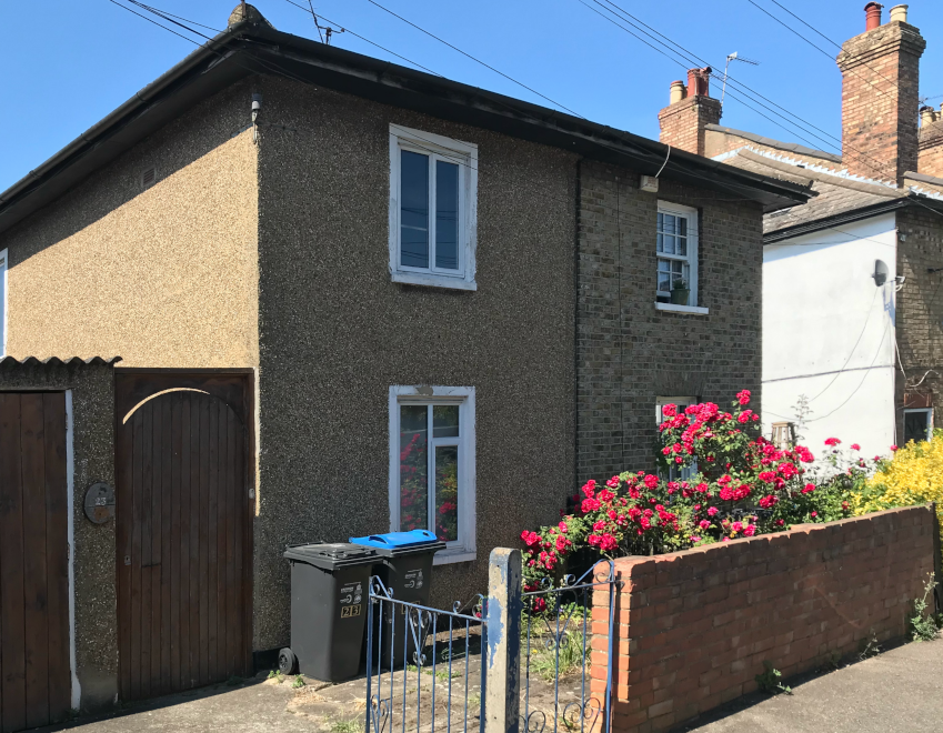
23 and 25 Love Lane. Photo taken 21st May 2020

Rose Cottage was the childhood home of William Henry SLATER, who emigrated to Australia in the late 1850s where he was one of the founders of the Mitcham township, now a suburb of Melbourne, Victoria.

This is followed by a terrace of 12 houses, numbered 27 to 49, which has the nameplate in the middle of ‘Douglas Cottages’. These were built in the first decade of the 20th century according to Montague., and were numbered 1 through 12, from west to east. In the 1915 directory Stewart Daniel SLATER, florist, is listed at no. 12.

1954 OS map

After Douglas Cottages is currently a nursery school, built in the early 1960s after a pair of semi-detached cottages, numbered 55 and 57, called Dent’s Cottages, was demolished. The Mitcham News & Mercury had an article in the 2nd September 1960 issue: 132-year old Love Lane cottage to come down.

Further along on the left hand side, after Dearn Gardens, are two detached houses that are set back from the road side at an angle, number 75 and number 77, the latter of which may have been called Glendene when it was occupied by George Victor DEARN, who developed Dearn Gardens.

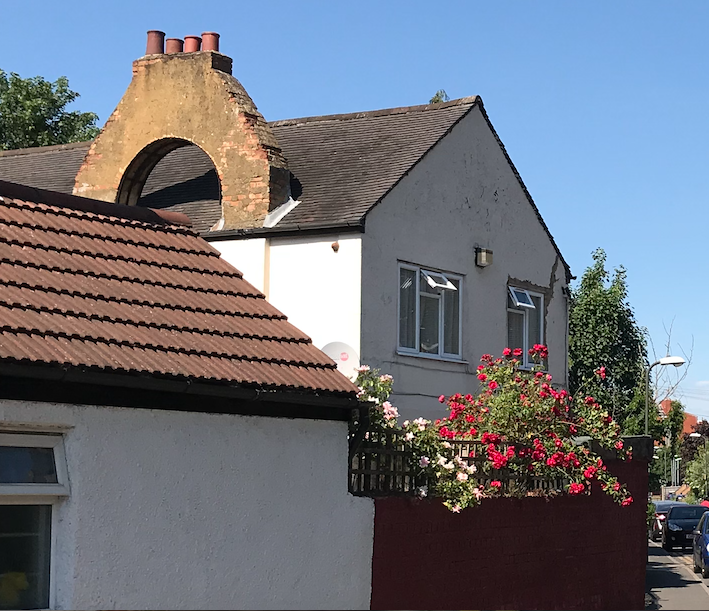
75 Love Lane with its arched chimney stacks. Photo taken 21st May 2020

Next is a 3-storey block of 6 flats, numbered 79, 81, 83 and 79a, 81a, 83a. After which is a block of 2 houses, 85 and 87, with a third added on, number 89.

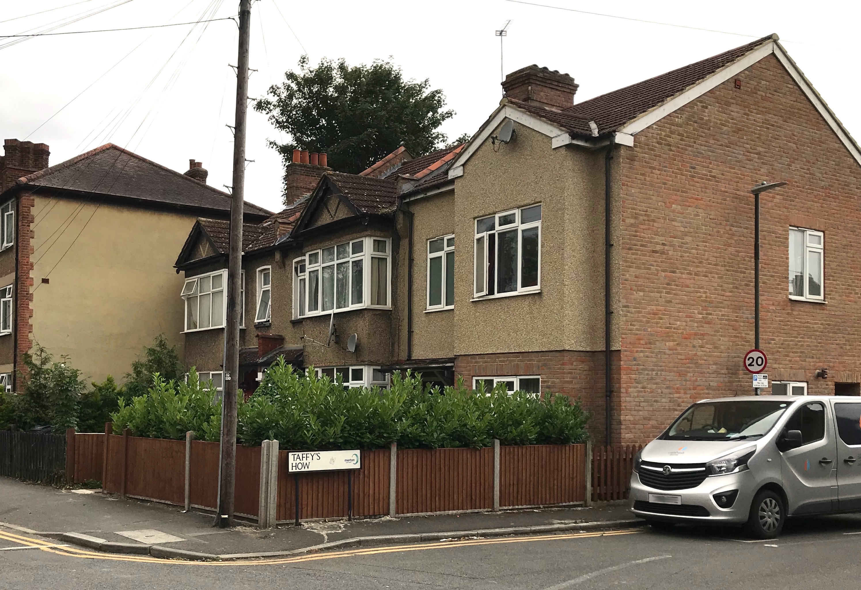
Corner of Love Lane and Taffy’s How shows no. 85, 87 and 89 Love Lane. Photo taken 15th July 2020

Houses numbers 103 to 121 were built in 1934 as part of the Pear Tree Close estate.

An older terrace of 4 houses, numbered 123 to 129, north of the corner with Westfield Road, dated from the 1880s, as are the similar houses on the north side of Westfield Road, according to Montague. The 1910-1911 street directory lists these houses as Knapdale Villas, with these occupants:

1, Frederick NEWSOM
2, Thomas ARTHUR
3, John HINCKLEY

A photo from around 1970 on Merton Memories, incorrectly labelled as Gladstone Road, shows these houses with their original slate roofs.

From Merton Memories, photo reference Mit_Streets_D_LEW_29-2

From the current footpath that leads to the Glebe Path and Queen Anne’s Gardens, on the right hand side of Love Lane northwards, were 6 pairs of semi-detached houses, five of which can be seen in this aerial photo from 1937.

1937 aerial photo from Britain From Above. Love Lane is on the right. Detached houses from right to left shown are numbers 100/102, 104/106, 108/110, 112/114, and 116/118.

No. 104/5. Clip of photo taken by Eric Montague in 1966. Reproduced by kind permission of the Merton Historical Society. Image reference mhs-em-wl-cr-9

Numbers 100/102 aren’t shown on this 1954 OS map, so may have been destroyed in the war. All six were demolished by the end of the 20th century and replaced by houses and bungalows.

1953 OS map reproduced by permission of the National Library of Scotland. Reuse CC-BY.

This 1910 OS map shows all 6 of the semi-detached houses.

1910 OS map

In the 1925 street directory, these houses were numbered from the Western Road end, from 1 sequentially to 12.

1, William John UPTON
2, John BICKNELL

3, John CARRETT
4, George William SLATER

5, Samuel Henry BATEMAN
6, Arthur Goodwin FUNNELL

7, Mrs GEORGE
8, Henry James STEERS

9, Hoseph George WHITE
10, Henry DEARN

11, Hames Joseph GRACE
12, Leonard George FORTNAM

In the 1898 street directory, no. 6 was also known as Ivy Cottage and no. 7 as Jasmine Cottage.


Maps are reproduced with the permission of the National Library of Scotland.

Tramlink

The Croydon Tramlink officially opened on 10th May 2000, and the last part of the network to come in to use was the route from Elmers End to Wimbledon, on 30th May 2000.

The eastbound platform at Mitcham tramstop. Photo taken 10th May 2020.

Mitcham tramstop, looking west towards the London Road. Photo taken 10th May 2020.

Approval by the government for the tram scheme, as well as one for Birmingham, was granted on 13th December 1994, as reported in the Financial Times the next day.

Financial Times, 14th December 1994.

Tram schemes win approval

Approval for tram systems to be built in Birmingham and the south London borough of Croydon was granted by the government yesterday. Both will be funded by a mix of pub¬lic and private capital.

Detailed proposals for the schemes, which are expected to require a total investment of £305m, have been prepared by private sponsors and local authorities. They were delayed for several years while awaiting government approval.

The schemes will depend on the private sector making a “significant” contribution to the total cost, Mr Brian Mawhinney, the transport sec-retary, said.

London Transport, one of the backers of the Croydon Tramlink, said the government’s statement represented an important step forward, but West Midlands Passenger Transport Authority criticised it as requiring too large a financial contribution from local authorities.

If the two schemes do proceed they will represent a significant boost to light rail systems in the UK. Manchester began operating trams in 1992, followed by Sheffield this year. Before that British cities had neglected trams for decades.

Croydon Tramlink is a 17-mile network aimed at speeding up journey times between Wimbledon, Croydon, Beckenham and New Addington. London Transport and Croydon Borough Council believe the private sector would be willing to provide more than half the £160m cost.

The Midland Metro would link central Birmingham with Wolverhampton over 13 miles of track, with the private sector contributing about £10.5m to the £145m cost.

Mr Richard Worrall, chairman of the West Midlands PTA, said it had already spent or promised £13m to aid preparations for the project. “We are being asked to commit further capital from resources we do not have,” he said.

Proposals for Croydon Tram¬link have been drawn up by a private consortium comprising German engineering group AEG, Tarmac Construction and Transdev, an operator of trams in France, but the project would be put out to open competition. The Midland Metro contract has already been won by a consortium comprising John Laing, the UK construction group, and Ansaldo Trasporti, an Italian supplier of rail systems.

Local residents received letters warning them of the construction that was in progress for the conversion of the railway line near their homes into tram track.

Letter dated 25th March 1998 to residents about site clearance.

Letter dated 22nd December 1998 to local residents about the overhead power line works.

Letter dated 10th April 2000 to local residents about track work near their homes as the tramlink nears completion.

A leaflet explained the system:

Welcome to our brand new local transport system

Tramlink’s 28km (18 miles) of track links Croydon to Wimbledon, Beckenham Junction, Elmers End and New Addington, allowing fast and efficient travel across South London and linking to many important train and bus routes, thus opening up a tremendous number of journey options for residents and visitors alike.

Our 24 new trams serve 38 stops along three routes, shortening journey times, reducing road traffic and pollution. Trams travel at up to 80km per hour in off street areas but run at low speed in pedestrian streets in Croydon town centre.

How Tramlink is starting

Tramlink’s three routes are opening in stages, starting with route 3 between New Addington and Croydon.
The initial timetables provide frequent services, every 7 minutes in the daytime on Mondays to Saturdays on route 3, and every 12 minutes on routes 1 and 2. Services will be monitored and timetables are subject to change.

Route map

Buying a Ticket

Tickets can be purchased from automatic ticket machines at all tram stops.

Full instructions are given on the machines, which accept both coins and notes and give change.

1. Each ticket machine has a wheel, which can be turned to select the destination required from a list displayed on screen.
2. When destination is highlighted simply press the green OK button located in the centre of the wheel.
3. Now turn the wheel again to select a ticket type from the choice available. Press the green OK button.
4. Check the details on the screen are correct and insert payment.
5. The ticket and any change can be collected from the slot below.

If change runs out a refund voucher is issued, which you can change at the Tramlink shop (in person or by post – we will refund postage costs), or ask a ticket inspector.

Tickets and Passes

The following tickets and passes are valid for journeys on Tramlink:

»Single/Return Tickets – please buy from the ticket machine at the tram stop or in the Tramlink shop. Single fares are 90p for any journey from Beckenham Junction, Elmers End or New Addington to the Zone 3 boundary at Morden Road or intermediately. For longer distance journeys which cross the Zone 3 boundary, the single fare is £1.30. Children aged 5-13 inclusive pay 40p single, also children aged 14 and 15 with a valid child rate photocard; child rate tickets are not sold for journeys starting between 2200 and 0429 – at these times the adult fare applies. Two accompanied children under 5 travel free. Return tickets (to avoid having to buy two tickets), cost twice the single fare.

» Bus/Tram Tickets for through transfer trips from bus routes T31, T32, T33, which cost the same as the tram only fare.

» Bus and Tram combined One Day Passes – buy from the Tramlink shop or PASS agents.

» LT Travelcards / LT Cards – Zones 4,5 or 6 Travelcards and LT Cards may be used anywhere on Tramlink except between Merton Park and Wimbledon, where Zone 3 validity is necessary.

» Freedom Passes issued by London Boroughs to Elderly, Disabled and Blind People are valid for free travel on Tramlink.

» LT Bus Passes are not valid on Tramlink.
For full details of tickets and passes validity, please see information on tram stops. A number of other ticketing initiatives are being developed and will be publicised at a later date.

Examples of tickets:

Reverse side of ticket