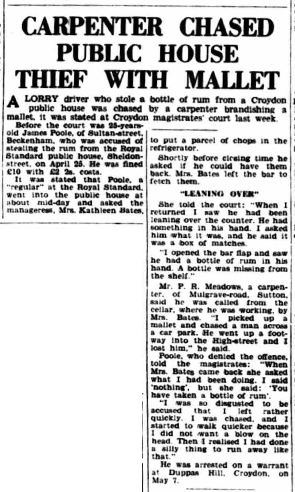
Royal Standard, 1 Sheldon Street, Croydon, CR0 1SS, the corner with Wandle Road.
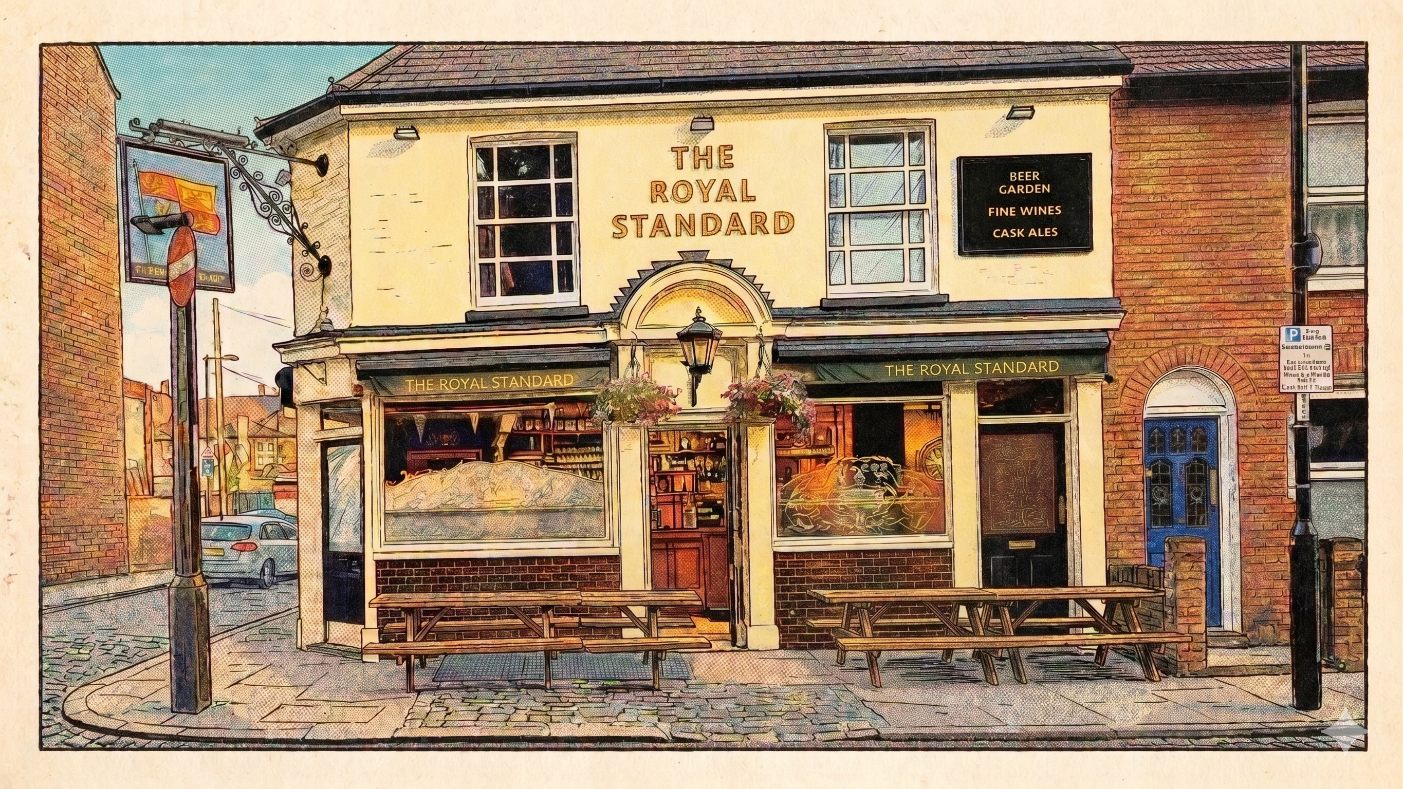
Based on a photo taken August 2025
For up to date information, see their Facebook page.
The road is named after Archbishop Gilbert Sheldon, who is buried at Croydon Minster.
Contents
Maps
Licensees
Newspaper Articles
Maps
Ordnance Survey maps are reproduced by permission of the National Library of Scotland, reuse CC-BY
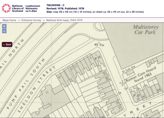
1970 OS map
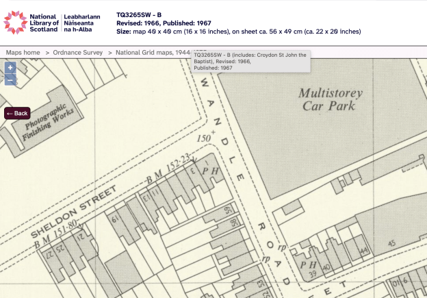
1966 OS map
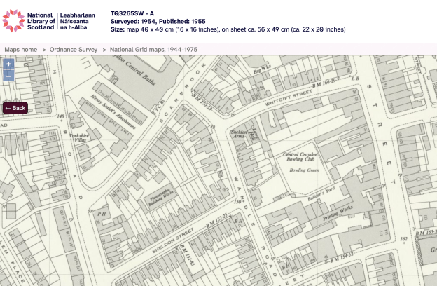
1954 OS map
Licensees
to 1909 – Alfred POWLEY
1909 – Albert Tress BODY
1926 to 1945 – William RUSS
1945 to Nov 1955 – Mr Alfred & Mrs Eileen VAUGHAN
Nov 1955 to Jan 1959 – Mr & Mrs. George HARVEY
Jan 1959 to 19?? – Mr & Mrs. E. SATES
Notes
Albert Tress BODY died 19th April 1919 at the pub.
News Articles
News items, most recent first. Some are via the British Newspaper Archive, which requires a subscription.
Lindisfarne
Croydon Advertiser Friday October 24 1986
REGULARS at Croydon’s Royal Standard pub were in distinguished musical company as they supped their ale last Thursday night Only they didn’t realise it! They were rubbing shoulders with Ray Jackson and Rod Clements members of the hugely successful Geordie band Lindisfarne Feeling in need of some liquid refreshment to lubricate the vocal cords the lads wandered out of the Croydon Court Hotel — their overnight billet during a whistle-stop tour to promote their forthcoming concert series — and after some time found themselves in this homely little pub. They gave it the thumbs up.
Croydon Times – Friday 18 May 1962 Image © Successor rightsholder unknown.
Croydon Times – Friday 18 May 1962
Croydon Times – Friday 30 January 1959
MOVING TO THE HARP Mr. and Mrs George Harvey, host and hostess of the Royal Standard, Sheldon-street, Croydon, are moving shortly to The Harp, in Parson’s Mead, West Croydon. It was badly damaged during the war and has now been completely re-built. Mr. and Mrs. E. S. Sates, of Dorking, have taken over The Standard.
Croydon Times – Friday 18 November 1955
New ‘mine hosts’ for Croydon MAKING their first venture in the licensed trade are Mr. and Mrs. George E. Harvey, who have taken over the Royal Standard Inn, at the corner of Wandle-road and Sheldon-street, Croydon. For 20 years, Mr. Harvey was a partner In the firm of G. Harvey and Son, furniture Lower Addiscombe-road, Croydon. As well as running the Inn, he will continue as manager of the furniture removals section of Turner’s Transport. Ltd., Croydon. He is a keen angler. New landlord of the Gun Tavern, Church Street, Croydon, is Mr. James Crawford Patterson, who succeeds Mr. Eric Evans. Mr. Sydney (Nick) Carter, formerly or the Bulls Head, Laud-street, Croydon, took over the Licence of the Cambridge Hotel, Upper Norwood, on Wednesday.
Croydon Times – Friday 13 August 1954
EX-LANDLORD OF ‘ROYAL STANDARD’ LANDLORD of the Royal Standard public house at the junction of Wandle-road and Sheldon-street, Croydon, for 19 years, Mr. William Russ has died at his son’s house, the “Spotted Cow” inn, Farnham, Surrey. At the age of 73 Mr. Russ, who was formerly at the Windmill Hotel, St James-road, left the Royal Standard nine years ago and afterwards worked at Hardstones’ Wine and Spirit Store, Brighton-road, South Croydon, prior to retiring to Farnham. His son-in-law is Bert Geary, the former Surrey county cricketer, and Mr. Russ himself in younger years was a keen amateur player. Mrs. Russ died about 15 months ago.


