In this 1913 OS Map, Manor Road was the name of the road at the northern edge of the Urban District boundary, and continued along past the Streatham Park Cemetery, then south towards Mitcham Common.
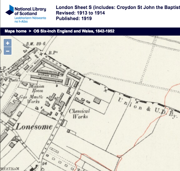
1913 OS Map
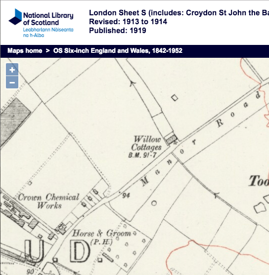
1913 OS Map
Parts of the road were renamed, after this suggestion in 1926:
From the minutes of the Mitcham Urban District Council
Highways, New Streets and Buildings, and Lighting Committee
Tuesday, 14th September, 1926
6. MANOR ROAD.
— Read letters from the Battersea District Post Office and the Streatham Park Cemetery Company suggesting the renaming of Manor Walk and a portion of Manor Road in order to prevent confusion.
Resolved to recommend, That the following names be adopted :
Manor Road, from Commonside East to a point 300 yards north-east of Willow Cottages ;
Northborough Road, from Manor Road to Croydon Boundary, and to be numbered from the Croydon end of the road ;
Rowan Road, from Manor and Northborough Road to Wandsworth boundary opposite No. 31, Greyhound Terrace ;
Greyhound Terrace, from Rowan Road to Lilian Road.
Newspaper Articles
191 Manor Road – from the Mitcham Advertiser – Thursday 20 October 1927
“A BIT O’ LUCK.” The True Tale of a Mitcham Cupboard, Not Exaggerated.—(Official). Mrs. Arkle, the wife of Quarter-master Gunner Arkle, came over from Chatham to Mitcham to see the new house her officer husband had bought from the Tamworth Park Construction Company. It is 191, Manor-road, ~ In the course of her inspection Mrs, Arkle placed her purse containing 30s, in Treasury notes and a few coppers on the top shelf of a cupboard. Workmen were in the house all the time, Two days later, when about to return to Chatham from London, where she was staying, she missed the purse and only remembered after an effort where she had laid it “I hurried back to the house,” she told the “Advertiser,” and found workmen still at work there. I asked one if he had seen a purse, and from the bhewildered exsression on his face I knew he had not. then looked in the cupboard and to my great delight, for money is money when you are paving for a house, and we are only poor people, the purse and its contents were exactly where I had left them. It was a marvellons bit of luck, I think.” “You are sure it was not £100,” said the “Advertiser” representative. Mrs, Arkle had just been told that an imaginative contemporary had accused her of leaving £100 in the house. Her reply was too poetical for these pages.“Another great myth exploded” chuckled her sailor husband.
World War 2 Connections
No. 78, 2nd. L/T. W. ROWNTREE joined the Home Guard
No. 127, Cpl. H. PLEDGE joined the Home Guard 15th October 1940
Civilian Casualties
17th October 1940
Mary Ellen KING, aged 56
22nd June 1944
Frederick William BAKER, aged 64
Minutes of meetings held by the Mitcham Urban District Council are available on request from the Merton Heritage and Local Studies Centre at Morden Library.
Maps are reproduced with the permission of the National Library of Scotland.


