Tag Archives: Preshaw Crescent

Glebe Path

Road that runs northwards off of the north side of Lower Green West.

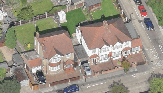
The houses were probably built in 1929 or later by Isaac Wilson. The title deeds for one of the houses up for auction in February 2017 show that he bought the land on 10th November, 1928.

A Conveyance of the land in this title and other land dated 10 November 1928 made between (1) The Revd. Charles Aubrey Finch (the Incumbent) (2) The Governors of the Bounty of Queen Anne for the Augmentation of the Maintenance of the Poor Clergy (3) Cyril Forster Bishop of Southwark (4) The Revd. Alard Charles De Bourvel (5) Randall Thomas Archbishop of Canterbury and (6) Isaac Henry Wilson (Purchaser)

On this 1867 OS map a path is shown across ‘glebe’ fields to the Glebelands house. These fields had been bought in the 18th century using the Queen Anne’s Bounty, which was a scheme for providing an income to the local clergy.
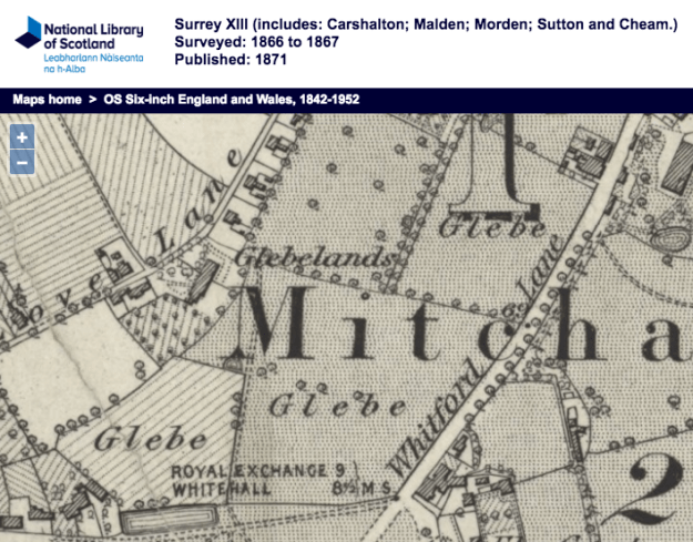
1867 OS map

1867 OS map

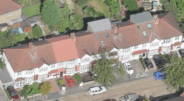
This 1910 OS map shows a road called Glebe Path, the row of houses on the left in Lower Green West is Preshaw Crescent, and the separate houses on the right were called Glebe Villas.
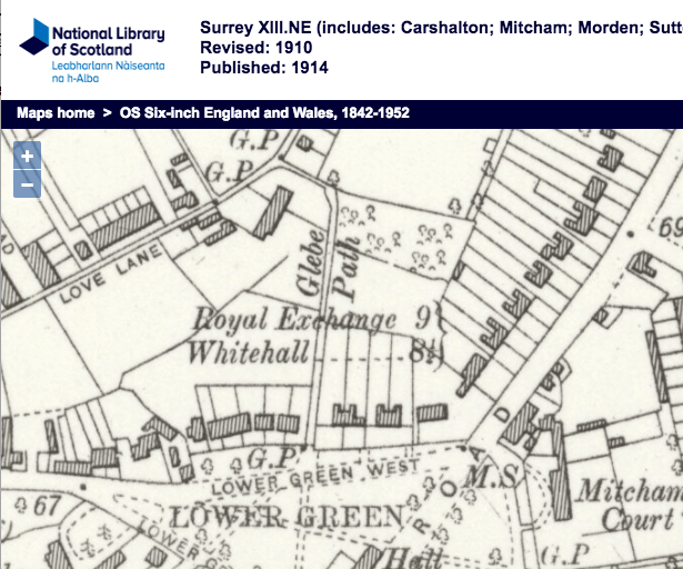
1910 OS map

1910 OS map

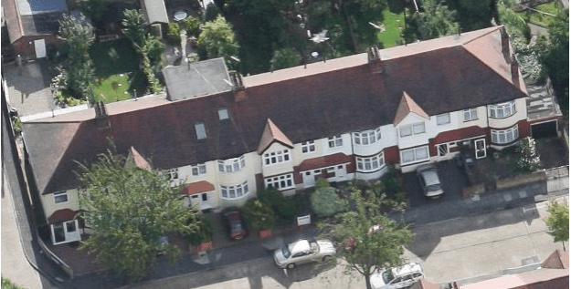
The OS map for 1953 shows the houses in this road. On the western, left hand side, going north, is a detached house, then a pair of houses before the junction with Russell Road which runs westward. North of Russell Road is a terrace of eight houses. On the eastern, or right hand side, the map shows a terrace of seven houses north of the junction with Russell Road opposite. At the north end of Glebe Path, the road turns right into Queen Annes Gardens.

1953 OS Map

1953 OS Map

Aerial photos

west side

west side

west side after Russell Road
west side after Russell Road

east side

east side

After the old people’s housing of Glebe Square had been built, an attempt in 1960 to renumber all the properties in Glebe Path was made by Mitcham Council, but the homeowners in the road protested. See Seven Defy The Council.


Maps are reproduced with the permission of the National Library of Scotland.
Queen Anne’s Bounty

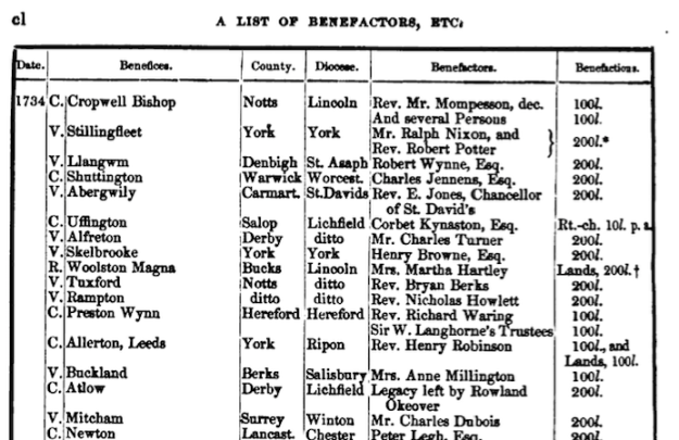
To help with the income of poor clergy, the Queen Anne’s Bounty was a sum of money used to buy land. This land was then rented out and this rental income was used to support the clergy.

In 1734, £200 of this Royal Bounty was used to buy an area of land from Charles Dubois in Mitcham, to support the vicar at the parish church.

Source: An Account of the Augmentation of Small Livings by “The Governors of the Bounty of Queen Anne for the Augmentation of the Maintenance of the poor Clergy” published in 1856, by Christoper Hodgson, M.A.

Source: An Account of the Augmentation of Small Livings by “The Governors of the Bounty of Queen Anne for the Augmentation of the Maintenance of the poor Clergy” published in 1856, by Christoper Hodgson, M.A.

Eric Montague, in his Mitcham Histories : 12 Church Street and Whitford Lane, page 107, said that more land was bought in 1762 from Mary Gellibrand.

This OS map of 1867 shows areas marked as ‘Glebe’. Note that the London Road was, as shown on this map, known as Whitford Lane.

1867 OS map

1867 OS map

Later, parts of this land was sold off to developers to build houses. Montague, page 108, ibid., said that in 1790 a substantial plot was sold to build a house which became Glebelands.

In the Land Registry title for a house in Preshaw Crescent for example, a conveyance was made in 1897:

A Conveyance of the land in this title and other land dated 2 September 1897 made between (1) The Reverend Frederick Wilson Clerk (the Incumbent) (2) The Governors of The Bounty of Queen Anne for the Augmentation of The Maintenance of The Poor Clergy (the Governors) (3) The Right Reverend Father in God Edward Stuart (the Ordinary) (4) Francis Charles Simpson (the Patron) (5) The Right Honourable and Most Reverend Frederick By Divine Providence Lord Archbishop of Canterbury (the Archbishop) and (6) Richard Arthur Bush (the Purchaser) contains covenants details of which are set out in the schedule of restrictive covenants hereto.

See also Queen Anne’s Bounty on wikipedia.


Maps are reproduced with the permission of the National Library of Scotland.